File:North American Plate map-fr.png
本预览的尺寸:800 × 346像素。 其他分辨率:320 × 139像素 | 640 × 277像素 | 1,024 × 443像素 | 1,280 × 554像素 | 2,956 × 1,280像素。
原始文件 (2,956 × 1,280像素,文件大小:1.63 MB,MIME类型:image/png)
| 描述 |
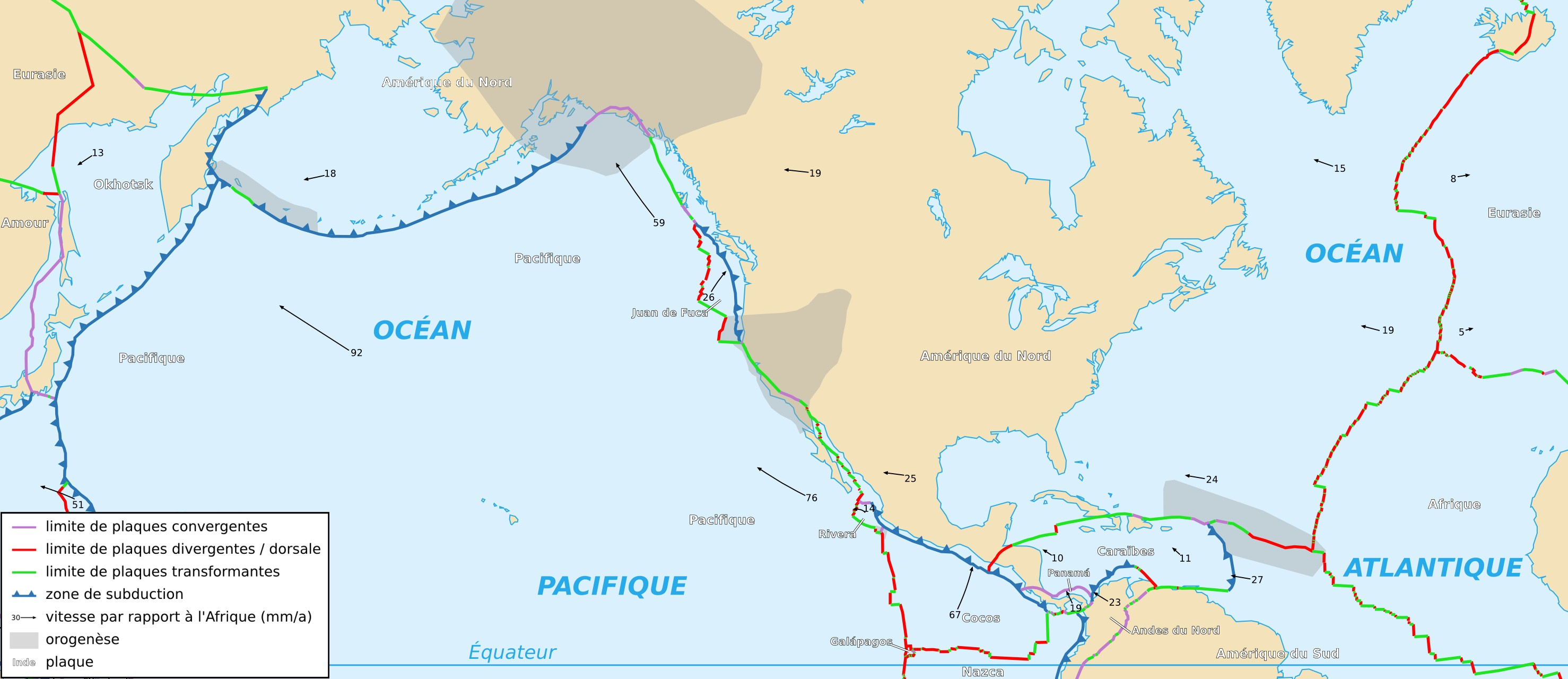
Français : Carte de la plaque nord-américaine English: Map of the North American Plate |
| 日期 | |
| 来源 | Cropped version by myself of Image:Tectonic_plates_boundaries_detailed-fr.svg created by Sting under CC-BY-SA |
| 作者 | Sting and Rémih |
| 授权 (二次使用本文件) |
本文件采用知识共享署名-相同方式共享 2.5 通用许可协议授权。
|
| 其他版本 |
Scaled version of  |
文件历史
点击某个日期/时间查看对应时刻的文件。
| 日期/时间 | 缩略图 | 大小 | 用户 | 备注 | |
|---|---|---|---|---|---|
| 当前 | 2006年11月18日 (六) 23:03 | | 2,956 × 1,280(1.63 MB) | Rémih | {{Information |Description={{fr|Carte de la plaque nord-américaine}}{{en|Map of the North American Plate}} |Source=Cropped version by myself of Image:Tectonic_plates_boundaries_detailed-fr.svg created by Sting under CC-BY-SA |Date=18/ |
文件用途
没有页面链接到本图像。
全域文件用途
以下其他wiki使用此文件:
- ca.wikipedia.org上的用途
- fr.wikipedia.org上的用途
- ja.wikipedia.org上的用途
- sh.wikipedia.org上的用途
- sr.wikipedia.org上的用途