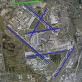
File:O'Hare International Airport (USGS) Phase1-corrected.png

本预览的尺寸:600 × 600像素。 其他分辨率:240 × 240像素 | 480 × 480像素 | 768 × 768像素 | 1,132 × 1,132像素。
原始文件 (1,132 × 1,132像素,文件大小:2.11 MB,MIME类型:image/png)
文件历史
点击某个日期/时间查看对应时刻的文件。
| 日期/时间 | 缩略图 | 大小 | 用户 | 备注 | |
|---|---|---|---|---|---|
| 当前 | 2009年2月18日 (三) 23:52 |  | 1,132 × 1,132(2.11 MB) | Mahahahaneapneap | Compressed |
| 2007年6月17日 (日) 00:17 |  | 1,132 × 1,132(2.13 MB) | Brianski | {{Information| |Description=O'Hare International Airport modernization program - phase 1 runway configuration (blue = existing, green = new, orange = removed) |Source=NASA World Wind Screenshot, USGS urban ortho; [http://egov.cityofchicago.org/city/we |
文件用途
以下页面使用本文件:
全域文件用途
以下其他wiki使用此文件:
- id.wikipedia.org上的用途
- pl.wikipedia.org上的用途
- ru.wikipedia.org上的用途

