File:Papal States 1789.svg

此SVG文件的PNG预览的大小:450 × 456像素。 其他分辨率:237 × 240像素 | 474 × 480像素 | 758 × 768像素 | 1,011 × 1,024像素 | 2,021 × 2,048像素。
原始文件 (SVG文件,尺寸为450 × 456像素,文件大小:799 KB)
摘要


.svg)
.svg)
.svg)
.svg)
.svg)


.svg)
.svg)
.svg)


.png)
.png)


.svg)


.svg)

.svg)


.svg)
.svg)
.svg)
.svg)


.svg)
.png)


.svg)


.svg)
.svg)


.svg)


.svg)


.svg)
.svg)
.svg)
.svg)
.svg)
.svg)
.svg)
_cropped.svg)
.svg)
.svg)
.svg)
.svg)
.svg)
.svg)
.svg)
.svg)
.svg)
.svg)
.svg)
.svg)
.svg)
.svg)
.svg)
.svg)
.svg)
.svg)
.svg)
.svg)
.svg)
.svg)
.svg)
.svg)
.svg)
.svg)
.svg)
.svg)
.svg)
.svg)
.svg)
.svg)
.svg)
.svg)
.svg)
.svg)
.svg)
.svg)
.svg)
.svg)
.svg)
.svg)
.svg)
.svg)
.svg)
许可协议
我,本作品著作权人,特此采用以下许可协议发表本作品:
本文件采用知识共享署名-相同方式共享 3.0 未本地化版本许可协议授权。
- 您可以自由地:
- 共享 – 复制、发行并传播本作品
- 修改 – 改编作品
- 惟须遵守下列条件:
- 署名 – 您必须对作品进行署名,提供授权条款的链接,并说明是否对原始内容进行了更改。您可以用任何合理的方式来署名,但不得以任何方式表明许可人认可您或您的使用。
- 相同方式共享 – 如果您再混合、转换或者基于本作品进行创作,您必须以与原先许可协议相同或相兼容的许可协议分发您贡献的作品。
原始上传日志
This image is a derivative work of the following images:
- File:Europe_1789.svg licensed with Cc-by-sa-3.0
- 2013-04-14T03:44:26Z Alphathon 450x456 (858577 Bytes) Corrected some errors in northern Italy
- 2013-04-14T01:38:01Z Alphathon 450x456 (853881 Bytes) tweaked again
- 2013-04-14T01:36:10Z Alphathon 450x456 (853881 Bytes) Tweaked Holy Roman Empire border style
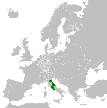
- 2013-04-14T01:33:26Z Alphathon 450x456 (853857 Bytes) == {{int:filedesc}} == {{Information |Description={{en|A blank Map of Europe circa 1789. This map also includes a border for the [[:en:Holy Roman Empire|Holy Roman Empire]]. Since there are so many small German states, they h
Uploaded with derivativeFX
文件历史
点击某个日期/时间查看对应时刻的文件。
| 日期/时间 | 缩略图 | 大小 | 用户 | 备注 | |
|---|---|---|---|---|---|
| 当前 | 2021年10月17日 (日) 07:58 | | 450 × 456(799 KB) | Fenn-O-maniC | Fixed the Russo-Swedish border to match the Treaty of Åbo of 1743 |
| 2013年4月18日 (四) 16:29 |  | 450 × 456(820 KB) | Alphathon | Various fixes (see blank version) | |
| 2013年4月14日 (日) 04:00 |  | 450 × 456(802 KB) | Alphathon | == {{int:filedesc}} == {{Information |Description={{en|A map the Papal States circa 1789.}}{{de|Eine Landkarte die Kirchenstaat c. 1989.}} |Source={{Derived from|Europe_1789.svg|display=50}} |Date=2013-04-14 03... |
文件用途
全域文件用途
以下其他wiki使用此文件:
- arz.wikipedia.org上的用途
- ast.wikipedia.org上的用途
- cdo.wikipedia.org上的用途
- cs.wikipedia.org上的用途
- en.wikipedia.org上的用途
- fr.wikipedia.org上的用途
- ga.wikipedia.org上的用途
- gl.wikipedia.org上的用途
- he.wikipedia.org上的用途
- hr.wikipedia.org上的用途
- ja.wikipedia.org上的用途
- ka.wikipedia.org上的用途
- ko.wikipedia.org上的用途
- mk.wikipedia.org上的用途
- oc.wikipedia.org上的用途
- sq.wikipedia.org上的用途
- tg.wikipedia.org上的用途
- ur.wikipedia.org上的用途
- www.wikidata.org上的用途
- xmf.wikipedia.org上的用途
- zh-min-nan.wikipedia.org上的用途