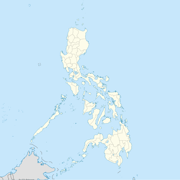
File:Philippines location map (square).svg

此SVG文件的PNG预览的大小:600 × 600像素。 其他分辨率:240 × 240像素 | 480 × 480像素 | 768 × 768像素 | 1,024 × 1,024像素 | 2,048 × 2,048像素 | 1,332 × 1,332像素。
原始文件 (SVG文件,尺寸为1,332 × 1,332像素,文件大小:1.49 MB)
文件历史
点击某个日期/时间查看对应时刻的文件。
| 日期/时间 | 缩略图 | 大小 | 用户 | 备注 | |
|---|---|---|---|---|---|
| 当前 | 2021年8月19日 (四) 10:17 |  | 1,332 × 1,332(1.49 MB) | AichiWikiFixer | Updated boundaries |
| 2021年6月18日 (五) 07:53 |  | 1,332 × 1,332(2.24 MB) | AichiWikiFixer | Map update. | |
| 2021年6月18日 (五) 03:55 |  | 1,332 × 1,332(2.23 MB) | AichiWikiFixer | Small changes. | |
| 2021年6月18日 (五) 03:49 |  | 1,332 × 1,332(2.23 MB) | AichiWikiFixer | External changes for boundaries and coastlines. | |
| 2021年6月17日 (四) 13:11 |  | 1,332 × 1,332(2.23 MB) | AichiWikiFixer | Additional islands, lakes, and updated coastlines. | |
| 2021年6月17日 (四) 10:34 |  | 1,332 × 1,332(2.23 MB) | AichiWikiFixer | Update boundaries. | |
| 2021年5月25日 (二) 02:04 |  | 1,332 × 1,332(2.22 MB) | HueMan1 | Reverted to version as of 07:24, 7 September 2020 (UTC) | |
| 2021年5月17日 (一) 07:11 |  | 1,332 × 1,332(3.72 MB) | Petriolo | Reverted to version as of 05:36, 3 May 2021 (UTC) The new administrative borders are based from the Philippine government websites (https://www.geoportal.gov.ph/; http://noah.up.edu.ph/), and is deemed accurate. These new files have reliable sources and there's no "beauty" in it if it is inaccurate in the first place. | |
| 2021年5月16日 (日) 14:00 |  | 1,332 × 1,332(2.22 MB) | AichiWikiFixer | Reverted to version as of 07:24, 7 September 2020 (UTC) (Borders seen as ugly) | |
| 2021年5月3日 (一) 05:36 |  | 1,332 × 1,332(3.72 MB) | Petriolo | updated with NAMRIA borders |
文件用途
超过100个页面使用本文件。 下面的列表只显示使用本文件的前100个页面。完整列表可用。
- 1954年亚洲运动会
- 1966年亚足联青年锦标赛
- 1970年亚足联青年锦标赛
- 1999年亚足联女子锦标赛
- 2012年內格羅斯地震
- 2016年达沃市爆炸
- 三寶顏機場
- 伊利甘
- 伊巴雅特
- 伊巴雅特機場
- 伊洛伊洛市
- 佬沃
- 佬沃國際機場
- 保和海
- 克拉克国际机场
- 克拉克自由港区
- 公主港國際機場
- 凯比兰市 (比利兰省)
- 加萊拉港
- 卡利博
- 卡利博國際機場
- 卡加延德奥罗
- 卡布堯
- 卡拉延市
- 卡拉潘
- 卢塞纳 (菲律宾)
- 哥打巴托市
- 土格加劳
- 圣婴圣殿
- 圣费尔南多 (拉乌尼翁)
- 圣费尔南多 (邦板牙)
- 塔尼翁海峡
- 奎松市
- 奥隆阿波
- 安蒂波洛
- 安赫勒斯
- 宿霧市
- 尼诺伊·阿基诺国际机场
- 巴丹群島
- 巴伦苏埃拉 (菲律宾)
- 巴士古
- 巴士古機場
- 巴布延群岛
- 巴拉巴克岛
- 巴拉巴克海峡
- 巴林坦群島
- 巴科洛德
- 巴西兰岛
- 帕拉尼亞克
- 帕特罗斯 (菲律宾)
- 帕西格
- 愛妮島機場
- 拉普拉普市
- 文珍俞巴
- 普林塞薩港
- 曼达卢永
- 曼達維市
- 武端市
- 武端機場
- 波羅島
- 独鲁万市
- 獨魯萬機場
- 甘米银岛
- 碧瑶市
- 科罗纳达尔
- 科雷希多岛
- 纳沃塔斯
- 罗德里格斯 (黎刹省)
- 美岸
- 群星公主號
- 艾爾尼多
- 苏里高
- 苏里高海峡
- 苏马拉加 (菲律宾)
- 菲律宾城市列表
- 菲律宾的巴洛克教堂
- 葛多菲多·洛莫斯機場
- 蘇比克灣
- 达斯马里尼亚斯
- 达沃市
- 迪纳加特群岛
- 達沃國際機場
- 里高市
- 錫布延海
- 錫萊市
- 锡亚高岛
- 锡布延岛
- 长滩岛
- 阿吉拉尔 (邦阿西楠省)
- 阿帕里
- 霍洛
- 霍洛机场
- 馬利金納市
- 馬尼拉灣
- 马卡蒂
- 马拉维危机
- 马拉翁
- 马礼劳
- 麥克坦-宿霧國際機場
- 黎牙實比機場
查看连接到这个文件的更多链接。
全域文件用途
以下其他wiki使用此文件:
- af.wikipedia.org上的用途
- ar.wikipedia.org上的用途
- arz.wikipedia.org上的用途
- ast.wikipedia.org上的用途
- Asturias (Filipines)
- Toboso
- Lucena (Filipines)
- Alcala
- Manila
- Módulu:Mapa de llocalización/datos/Filipines
- Mar de Joló
- Luzón
- Komisyon sa Wikang Filipino
- Mar de Visayas
- Mindanao
- Lingayén
- Tarlac
- Vigan
- Dávao
- Complexu del Batasang Pambansa
- Ríu Pásig
- Estrechu de Mindoro
- Estrechu de Luzón
- Islles de Calamianes
- Módulu:Mapa de llocalización/datos/Filipines/usu
- Aeropuertu Internacional Ninoy Aquino
- Pasay
- Parañaque
- Universidá de Bulacán
- Aeropuertu Daniel Z. Romuáldez
- Aeropuertu Evelio Javier
- Aeropuertu Francisco B. Reyes
- Aeropuertu Godofredo P. Ramos
- Aeropuertu d'Awang
- Aeropuertu de Bancasi
- Aeropuertu de Dipolog
- Aeropuertu d'Ipil
- Aeropuertu de Joló
- Aeropuertu de Labo
- Aeropuertu de Laguindingán
- Aeropuertu de Lumbia
- Aeropuertu de Naga
- Aeropuertu de Pagadían
查看本文件的更多全域用途。


