File:Stockport bus station - geograph.org.uk - 1413991 cropped.jpg
本预览的尺寸:800 × 456像素。 其他分辨率:320 × 182像素 | 640 × 365像素 | 930 × 530像素。
原始文件 (930 × 530像素,文件大小:310 KB,MIME类型:image/jpeg)
| 描述 |
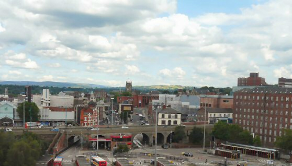
English: Stockport bus station, Stockport, Greater Manchester, England as viewed from the viaduct. Another view. In mid-distance is St Mary's church and to the right is the Hat Museum. |
| 日期 | |
| 来源 |
本檔案衍生自: Stockport bus station - geograph.org.uk - 1413991.jpg |
| 作者 |
|
| 署名 (由许可协议要求) | Gerald England / Stockport bus station / |
| 相机位置 | | 在以下服务上查看本图像和附近其他图像: OpenStreetMap |
|---|
| 这是一张修改过的图片,这意味着它已在原版本的基础上通过软件进行了编辑,改动内容:cropped。其原始版本为:Stockport bus station - geograph.org.uk - 1413991.jpg。修改者: BaldBoris。
|
本文件采用知识共享署名-相同方式共享 2.0 通用许可协议授权。
署名: Gerald England
- 您可以自由地:
- 共享 – 复制、发行并传播本作品
- 修改 – 改编作品
- 惟须遵守下列条件:
- 署名 – 您必须对作品进行署名,提供授权条款的链接,并说明是否对原始内容进行了更改。您可以用任何合理的方式来署名,但不得以任何方式表明许可人认可您或您的使用。
- 相同方式共享 – 如果您再混合、转换或者基于本作品进行创作,您必须以与原先许可协议相同或相兼容的许可协议分发您贡献的作品。
原始上传日志
This image is a derivative work of the following images:
- File:Stockport_bus_station_-_geograph.org.uk_-_1413991.jpg licensed with Cc-by-sa-2.0, Geograph
Uploaded with derivativeFX
文件历史
点击某个日期/时间查看对应时刻的文件。
| 日期/时间 | 缩略图 | 大小 | 用户 | 备注 | |
|---|---|---|---|---|---|
| 当前 | 2015年6月17日 (三) 17:21 | | 930 × 530(310 KB) | Joe Vitale 5 | better image |
| 2011年6月19日 (日) 21:40 |  | 640 × 320(112 KB) | BaldBoris | {{Information |Description={{en|1=Stockport bus station The bus station 1135589 at Stockport as viewed from the viaduct. In mid-distance is St Mary's church 1405627 and to the right is the Hat Museum 1349948.}} |date=2009-07-25 |Source=*[[:Fil |
文件用途
以下页面使用本文件:
全域文件用途
以下其他wiki使用此文件:
- an.wikipedia.org上的用途
- ar.wikipedia.org上的用途
- arz.wikipedia.org上的用途
- ast.wikipedia.org上的用途
- azb.wikipedia.org上的用途
- az.wikipedia.org上的用途
- be.wikipedia.org上的用途
- cs.wikipedia.org上的用途
- cy.wikipedia.org上的用途
- da.wikipedia.org上的用途
- de.wikivoyage.org上的用途
- en.wikivoyage.org上的用途
- eo.wikipedia.org上的用途
- eu.wikipedia.org上的用途
- fr.wikipedia.org上的用途
- ga.wikipedia.org上的用途
- he.wikipedia.org上的用途
- hy.wikipedia.org上的用途
- it.wikipedia.org上的用途
- it.wikivoyage.org上的用途
- ka.wikipedia.org上的用途
- ko.wikipedia.org上的用途
- lld.wikipedia.org上的用途
- nl.wikipedia.org上的用途
- nn.wikipedia.org上的用途
- pt.wikipedia.org上的用途
- ro.wikipedia.org上的用途
- ru.wikipedia.org上的用途
- sco.wikipedia.org上的用途
- sr.wikipedia.org上的用途
- sv.wikipedia.org上的用途
- sw.wikipedia.org上的用途
- th.wikipedia.org上的用途
- tr.wikipedia.org上的用途
- tt.wikipedia.org上的用途
- uk.wikipedia.org上的用途
- uk.wikivoyage.org上的用途
- ur.wikipedia.org上的用途
- www.wikidata.org上的用途
- zh-yue.wikipedia.org上的用途