File:Tehran Night Panorama.jpg
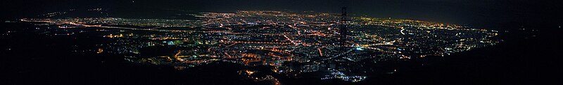
本预览的尺寸:800 × 122像素。 其他分辨率:320 × 49像素 | 640 × 97像素 | 4,603 × 700像素。
原始文件 (4,603 × 700像素,文件大小:470 KB,MIME类型:image/jpeg)
摘要
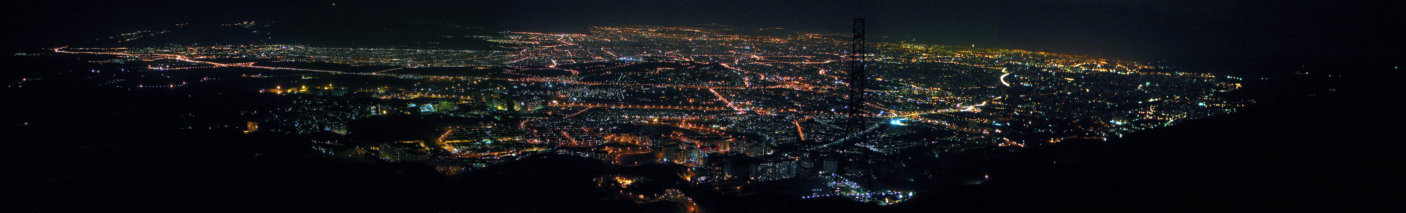
| 描述 | Tehran, Iran. Generated from 7 shots. Tehran is one of the biggest cities all over the world, it is 250km from east to west and 50 km from north to south! |
| 日期 | |
| 来源 | Tehran Night Panorama |
| 作者 | Hamed Saber from Tehran, Iran |
| 相机位置 | | 在以下服务上查看本图像和附近其他图像: OpenStreetMap |
|---|
许可协议
| 这幅图片原始出处为Flickr的https://www.flickr.com/photos/44124425616@N01/139592515 ,作者为Hamed Saber 。经机器人FlickreviewR在2008年2月5日审查后确定为采用cc-by-2.0的协议授权使用。 |
文件历史
点击某个日期/时间查看对应时刻的文件。
| 日期/时间 | 缩略图 | 大小 | 用户 | 备注 | |
|---|---|---|---|---|---|
| 当前 | 2008年1月28日 (一) 19:25 | 4,603 × 700(470 KB) | Jacoplane | {{Information |Description= Breaking news! (2006/07/08): '' With my new pro account, I replaced the panorama with a larger size. (Not the original, but a bigger one. Although this is my first panorama try and has too many problems!) You can view the detai |
文件用途
以下页面使用本文件:
全域文件用途
以下其他wiki使用此文件:
- ar.wikipedia.org上的用途
- av.wikipedia.org上的用途
- azb.wikipedia.org上的用途
- az.wiktionary.org上的用途
- bg.wikipedia.org上的用途
- bn.wikipedia.org上的用途
- ca.wikipedia.org上的用途
- cs.wikipedia.org上的用途
- en.wikipedia.org上的用途
- eo.wikipedia.org上的用途
- eu.wikipedia.org上的用途
- fa.wikipedia.org上的用途
- hi.wikipedia.org上的用途
- hr.wikipedia.org上的用途
- it.wikipedia.org上的用途
- ja.wikipedia.org上的用途
- kk.wikipedia.org上的用途
- kn.wikipedia.org上的用途
- ko.wikipedia.org上的用途
- nl.wikipedia.org上的用途
- roa-tara.wikipedia.org上的用途
- sh.wikipedia.org上的用途
- sr.wikipedia.org上的用途
- te.wikipedia.org上的用途
- th.wikipedia.org上的用途
- uk.wikipedia.org上的用途
- uz.wikipedia.org上的用途
- vi.wikipedia.org上的用途
- yi.wikipedia.org上的用途