File:Terschelling 5.35765E 53.40913N.jpg

本预览的尺寸:800 × 599像素。 其他分辨率:320 × 240像素 | 640 × 479像素 | 1,024 × 766像素 | 1,280 × 958像素。
原始文件 (1,280 × 958像素,文件大小:121 KB,MIME类型:image/jpeg)
摘要
| 描述 |
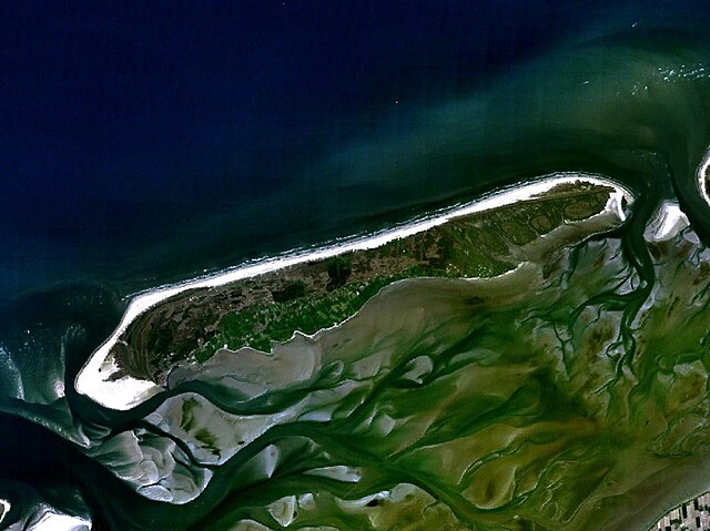
English: Terschelling, The Netherlands. Satellite view. |
| 日期 | 2005年5月17日 (上传日期) |
| 来源 | Satellite imagery taken from NASA World Wind software (by screenshot) |
| 作者 | NASA |
| 物体位置 | | 在以下服务上查看本图像和附近其他图像: OpenStreetMap |
|---|
许可协议
| 本圖像屬於公有領域,因其為NASA的World Wind衛星地圖瀏覽器的一張截圖,且使用了公有領域圖層,如Blue Marble、MODIS、Landsat、SRTM、USGS、GLOBE等。
|
 |
文件历史
点击某个日期/时间查看对应时刻的文件。
| 日期/时间 | 缩略图 | 大小 | 用户 | 备注 | |
|---|---|---|---|---|---|
| 当前 | 2005年5月17日 (二) 12:06 | | 1,280 × 958(121 KB) | Rex | Terschelling, The Netherlands NASA World Wind screenshot. {{PD-USGov-NASA}} Category:Maps of the Netherlands |
文件用途
以下页面使用本文件:
全域文件用途
以下其他wiki使用此文件:
- an.wikipedia.org上的用途
- br.wikipedia.org上的用途
- ca.wikipedia.org上的用途
- ceb.wikipedia.org上的用途
- de.wikipedia.org上的用途
- en.wikipedia.org上的用途
- eo.wikipedia.org上的用途
- es.wikipedia.org上的用途
- fa.wikipedia.org上的用途
- fr.wikipedia.org上的用途
- hak.wikipedia.org上的用途
- he.wikipedia.org上的用途
- hu.wikipedia.org上的用途
- ja.wikipedia.org上的用途
- ko.wikipedia.org上的用途
- li.wikipedia.org上的用途
- nds-nl.wikipedia.org上的用途
- nl.wikipedia.org上的用途
- nn.wikipedia.org上的用途
- no.wikipedia.org上的用途
- pl.wikipedia.org上的用途
- pt.wikipedia.org上的用途
- sv.wikipedia.org上的用途
- uk.wikipedia.org上的用途
- zh-min-nan.wikipedia.org上的用途