File:Tropical Depression One 2009 GOES.jpg

本预览的尺寸:800 × 600像素。 其他分辨率:320 × 240像素 | 640 × 480像素 | 1,024 × 768像素 | 1,280 × 960像素。
原始文件 (1,280 × 960像素,文件大小:1,021 KB,MIME类型:image/jpeg)
摘要
| 描述 |
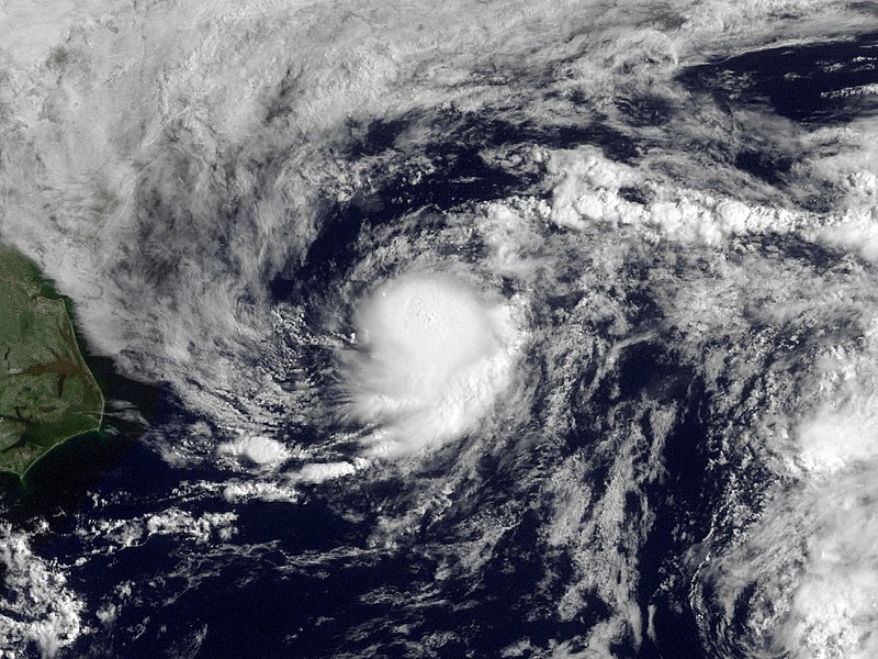
English: Shower activity has increased this morning in association with the area of low pressure located about 225 miles east-northeast of Cape Hatteras North Carolina. The low is currently moving to the northeast at 15 MPH along the relatively warm waters of the gulf stream. This system still has some potential to become a tropical cyclone over the next 12-24 hours but is not expected to threaten any land areas. |
| 日期 | |
| 来源 | http://www.nnvl.noaa.gov/MediaDetail.php?MediaID=210&MediaTypeID=1 |
| 作者 | NOAA; GOES |
| 授权 (二次使用本文件) |
Public domain |
许可协议
本图像属于公有领域,因该作品最初来自于美国国家海洋和大气管理局职员的职务作品。
|
文件历史
点击某个日期/时间查看对应时刻的文件。
| 日期/时间 | 缩略图 | 大小 | 用户 | 备注 | |
|---|---|---|---|---|---|
| 当前 | 2013年3月18日 (一) 20:27 | | 1,280 × 960(1,021 KB) | Supportstorm | Fix |
| 2010年5月14日 (五) 23:02 |  | 1,280 × 960(1,001 KB) | Supportstorm | Contrast Correction | |
| 2009年8月15日 (六) 20:09 |  | 1,280 × 960(886 KB) | Cyclonebiskit | {{Information |Description={{en|1=Shower activity has increased this morning in association with the area of low pressure located about 225 miles east-northeast of Cape Hatteras North Carolina. The low is currently moving to the northeast at 15 MPH along |
文件用途
以下7个页面使用本文件:
全域文件用途
以下其他wiki使用此文件:
- bg.wikipedia.org上的用途
- de.wikipedia.org上的用途
- en.wikipedia.org上的用途
- es.wikipedia.org上的用途
- eu.wikipedia.org上的用途
- fr.wikipedia.org上的用途
- nl.wikipedia.org上的用途
- pt.wikipedia.org上的用途
- ru.wikipedia.org上的用途