File:Tropical Storm Kay (2004).JPG

本预览的尺寸:600 × 600像素。 其他分辨率:240 × 240像素 | 480 × 480像素 | 768 × 768像素 | 1,024 × 1,024像素。
原始文件 (1,024 × 1,024像素,文件大小:711 KB,MIME类型:image/jpeg)
摘要
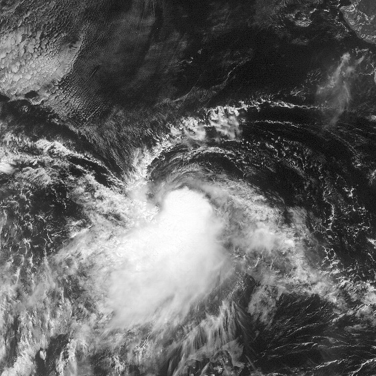
| 描述 | This image of Tropical Storm Kay was captured by the GOES-12 satellite on October 5, 2004 at 1445 UTC. Kay was located in the Pacific Ocean with peak intensity winds of 45 mph and a minimum pressure of approximately 1004 mb. | ||||||
| 日期 | |||||||
| 来源 | http://www.nrlmry.navy.mil/tc_pages/tc_home.html | ||||||
| 作者 | Naval Research Laboratory | ||||||
| 授权 (二次使用本文件) |
|
||||||

.JPG?uselang=zh)
.JPG?uselang=zh)
.JPG?action=history&uselang=zh)
.JPG)
文件历史
点击某个日期/时间查看对应时刻的文件。
| 日期/时间 | 缩略图 | 大小 | 用户 | 备注 | |
|---|---|---|---|---|---|
| 当前 | 2012年6月3日 (日) 22:52 | | 1,024 × 1,024(711 KB) | Supportstorm | image didn't renew |
| 2012年6月3日 (日) 22:50 |  | 1,024 × 1,024(711 KB) | Supportstorm | Better version | |
| 2006年9月24日 (日) 14:55 |  | 898 × 898(261 KB) | Good kitty | peak intensity | |
| 2006年7月6日 (四) 18:35 |  | 800 × 800(147 KB) | Hurricanehink | {{Information |Description=Tropical Storm Key Priro to becoming a tropical storm |Source=http://www.nrlmry.navy.mil/tc-bin/tc_display.cgi?BASIN=EPAC&STORM_NAME=14E.KAY&ACTION=Latest_Photos&ACTIVES=None&MOSAIC_SCALE=20&PHOT=yes&ATCF_BASIN=ep&CGI=TC&AGE=Pre |
文件用途
以下页面使用本文件:
全域文件用途
以下其他wiki使用此文件:
- de.wikipedia.org上的用途
- pt.wikipedia.org上的用途
.JPG)