File:Typhoon Keith (1997).png
本预览的尺寸:486 × 599像素。 其他分辨率:195 × 240像素 | 538 × 663像素。
原始文件 (538 × 663像素,文件大小:414 KB,MIME类型:image/png)
.png?uselang=zh)
.png?uselang=zh)
.png?action=history&uselang=zh)
.png)
摘要
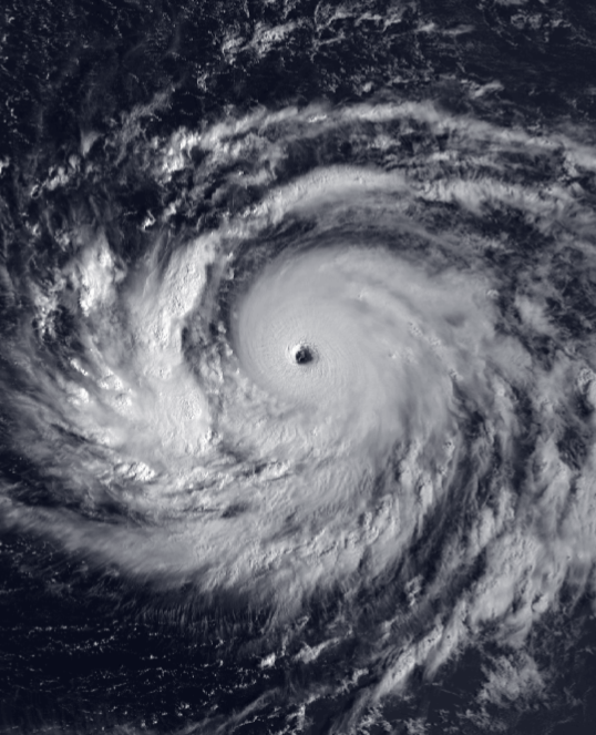
| 描述 | Typhoon Keith approaching the Marianas Islands on October 31, 1997, while near peak intensity. | |||
| 日期 | ||||
| 来源 | NOAA NESDIS satellite imagery: 1997 Pacific typhoons | |||
| 作者 | NOAA-NESDIS satellite imagery | |||
| 授权 (二次使用本文件) |
|
文件历史
点击某个日期/时间查看对应时刻的文件。
| 日期/时间 | 缩略图 | 大小 | 用户 | 备注 | |
|---|---|---|---|---|---|
| 当前 | 2021年2月9日 (二) 14:47 | | 538 × 663(414 KB) | Nino Marakot | Reverted to version as of 05:05, 4 May 2018 (UTC) Unexplained revert |
| 2021年2月5日 (五) 05:42 |  | 1,000 × 667(431 KB) | Sanvid2395 | Reverted to version as of 20:37, 14 September 2006 (UTC) | |
| 2018年5月4日 (五) 05:05 |  | 538 × 663(414 KB) | Saxitoxin | Colored | |
| 2006年9月14日 (四) 20:37 |  | 1,000 × 667(431 KB) | CapeVerdeWave~commonswiki | == Summary == {{Information |Description=Typhoon Keith approaching the Marianas Islands on October 31, 1997, while near peak intensity. |Source= |Date= 31 October 1997 |Author= NOAA-NESDIS satellite imagery |Permission= {{PD-USGov-NOAA}} |other_versions= |
文件用途
以下页面使用本文件:
全域文件用途
以下其他wiki使用此文件:
- en.wikipedia.org上的用途
- ja.wikipedia.org上的用途
- ko.wikipedia.org上的用途
- pt.wikipedia.org上的用途
- ru.wikipedia.org上的用途
- sv.wikipedia.org上的用途
- uk.wikipedia.org上的用途
- vi.wikipedia.org上的用途
.png)