File:Vicksburg harbor aerial view.jpg

本预览的尺寸:800 × 533像素。 其他分辨率:320 × 213像素 | 640 × 427像素 | 1,024 × 683像素 | 1,500 × 1,000像素。
原始文件 (1,500 × 1,000像素,文件大小:515 KB,MIME类型:image/jpeg)
| 描述 |
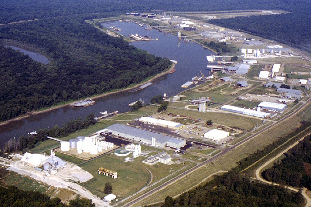
English: Aerial view of the Vicksburg Harbor, which is located on an arm of the Mississippi River at Vicksburg, Mississippi, USA. The harbor is located north of the main part of the city. View is to the west-northwest. |
|||
| 日期 | ||||
| 来源 |
U.S. Army Corps of Engineers Digital Visual Library Image page Image description page Digital Visual Library home page |
|||
| 作者 | Brad Emerson, U.S. Army Corps of Engineers | |||
| 授权 (二次使用本文件) |
|
|||
| 图中地点 | Vicksburg, Mississippi, USA |
| 相机位置 | | 在以下服务上查看本图像和附近其他图像: OpenStreetMap |
|---|
文件历史
点击某个日期/时间查看对应时刻的文件。
| 日期/时间 | 缩略图 | 大小 | 用户 | 备注 | |
|---|---|---|---|---|---|
| 当前 | 2007年4月6日 (五) 00:52 | | 1,500 × 1,000(515 KB) | DanMS | {{Information | Description = {{en|Aerial view of the Vicksburg Harbor, which is located on an arm of the Mississippi River at Vicksburg, Mississippi, USA. The harbor is located north of the main part of the city. View is to the west-northwest.}} | |
文件用途
以下页面使用本文件:
全域文件用途
以下其他wiki使用此文件:
- fa.wikipedia.org上的用途
- ja.wikipedia.org上的用途
- la.wikipedia.org上的用途
- ru.wikipedia.org上的用途
- sh.wikipedia.org上的用途
- sr.wikipedia.org上的用途
- uz.wikipedia.org上的用途
- vi.wikipedia.org上的用途