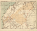
File:Western Sahara 1876.png

本预览的尺寸:698 × 600像素。 其他分辨率:279 × 240像素 | 559 × 480像素 | 746 × 641像素。
原始文件 (746 × 641像素,文件大小:882 KB,MIME类型:image/png)
文件历史
点击某个日期/时间查看对应时刻的文件。
| 日期/时间 | 缩略图 | 大小 | 用户 | 备注 | |
|---|---|---|---|---|---|
| 当前 | 2017年3月4日 (六) 08:36 |  | 746 × 641(882 KB) | Koavf | whitespace |
| 2017年3月3日 (五) 23:42 |  | 1,366 × 641(953 KB) | Kenzahurts | User created page with UploadWizard |
文件用途
以下页面使用本文件:
全域文件用途
以下其他wiki使用此文件:
- ar.wikipedia.org上的用途
- ca.wikipedia.org上的用途
- cs.wikipedia.org上的用途
- en.wikipedia.org上的用途
- eo.wikipedia.org上的用途
- es.wikipedia.org上的用途
- it.wikipedia.org上的用途
- ja.wikipedia.org上的用途
- pt.wikipedia.org上的用途
- ru.wikipedia.org上的用途
- te.wikipedia.org上的用途
- th.wikipedia.org上的用途
- uk.wikipedia.org上的用途
