File:Západní Sibiř.png
本预览的尺寸:800 × 572像素。 其他分辨率:320 × 229像素 | 640 × 457像素 | 946 × 676像素。
原始文件 (946 × 676像素,文件大小:785 KB,MIME类型:image/png)
| 描述 |
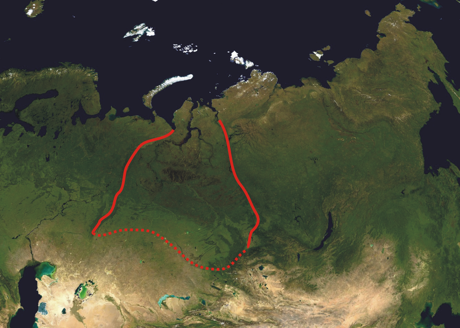
A composed satellite photograph of Asia in orthographic projection This is NASA "Blue Marble" image applied as a texture on a sphere using Art of Illusion program. The observer is centered at (40° N, 85° E), at Moon distance above the Earth. This modification describes boundaries of West Siberian Plain (red line). |
| 日期 | (UTC) |
| 来源 | |
| 作者 |
|
| 这是一张修改过的图片,这意味着它已在原版本的基础上通过软件进行了编辑。其原始版本为:Asia satellite orthographic.jpg。
|
| 本文件完全由NASA创作,在美国属于公有领域。根据NASA的版权方针,NASA的材料除非另有声明否则不受版权保护。(参见Template:PD-USGov/zh、NASA版权方针页面或JPL图片使用方针。) | ||
 |
警告:
|
原始上传日志
This image is a derivative work of the following images:
- File:Asia_satellite_orthographic.jpg licensed with PD-USGov-NASA
- 2005-04-19T11:33:19Z Ghalas 1887x1962 (875143 Bytes) A composed satellite photograph of [[:en:Asia|Asia]] in [[:en:Orthographic_projection_(cartography)|orthographic projection]] This is NASA [http://visibleearth.nasa.gov/view_rec.php?vev1id=11656 "Blue Marble"] image applied
Uploaded with derivativeFX
文件历史
点击某个日期/时间查看对应时刻的文件。
| 日期/时间 | 缩略图 | 大小 | 用户 | 备注 | |
|---|---|---|---|---|---|
| 当前 | 2010年4月4日 (日) 18:41 | | 946 × 676(785 KB) | Hanzs~commonswiki | {{Information |Description=A composed satellite photograph of Asia in orthographic projection This is NASA [http://visibleearth.nasa.gov/view_rec.php?vev1id=11656 "Blue Marble"] image applied as |
文件用途
以下页面使用本文件:
全域文件用途
以下其他wiki使用此文件:
- ar.wikipedia.org上的用途
- bg.wikipedia.org上的用途
- ca.wikipedia.org上的用途
- ckb.wikipedia.org上的用途
- cs.wikipedia.org上的用途
- cy.wikipedia.org上的用途
- el.wikipedia.org上的用途
- en.wikipedia.org上的用途
- fa.wikipedia.org上的用途
- fi.wikipedia.org上的用途
- fr.wikipedia.org上的用途
- gl.wikipedia.org上的用途
- hak.wikipedia.org上的用途
- hr.wikipedia.org上的用途
- hy.wikipedia.org上的用途
- ja.wikipedia.org上的用途
- kk.wikipedia.org上的用途
- ky.wikipedia.org上的用途
- ml.wikipedia.org上的用途
- ru.wikipedia.org上的用途
- sk.wikipedia.org上的用途
- sr.wikipedia.org上的用途
- sw.wikipedia.org上的用途
- ta.wikipedia.org上的用途
- uk.wikipedia.org上的用途
- vi.wikipedia.org上的用途
- www.wikidata.org上的用途