尼烏科普
荷兰南荷兰省市镇
尼烏科普(荷蘭語:Nieuwkoop,荷蘭語:[ˈniu̯koːp] (ⓘ),意為「新墾地」)是荷蘭南荷蘭省的一個市鎮,建立於2007年1月1日,由利梅爾(Liemeer)和泰爾阿爾(Ter Aar)合併而來。
| 尼烏科普 Nieuwkoop | |||
|---|---|---|---|
| 市鎮 | |||
 尼烏科普湖(Nieuwkoopse plassen) | |||
| |||
.svg) 尼烏科普在南荷蘭省的位置 | |||
| 坐標:52°11′N 4°46′E / 52.183°N 4.767°E座標:52°11′N 4°46′E / 52.183°N 4.767°E | |||
| 國家 | |||
| 省份 | 南荷蘭省 | ||
| 政府[1] | |||
| • 行政機構 | 市議會 | ||
| • 市長 | Robbert-Jan van Duijn (CDA) | ||
| 面積[2] | |||
| • 總計 | 91.16 平方公里(35.20 平方英里) | ||
| • 陸地 | 78.05 平方公里(30.14 平方英里) | ||
| • 水域 | 13.11 平方公里(5.06 平方英里) | ||
| 海拔[3] | −5 公尺(−16 英尺) | ||
| 人口(1月 2019)[4] | |||
| • 總計 | 28,628人 | ||
| • 密度 | 367人/平方公里(950人/平方英里) | ||
| 時區 | CET(UTC+1) | ||
| • 夏時制 | CEST(UTC+2) | ||
| 郵政編碼 | 2420–2441, 2460–2461, 3651–3653 | ||
| 電話區號 | 0172, 0297 | ||
| 網站 | www | ||

圖集 編輯
-
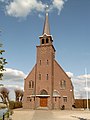 教堂
教堂 -
 吊橋
吊橋


參考資料 編輯
- ^ College van B&W [Board of mayor and aldermen]. Gemeente Nieuwkoop. [16 August 2013]. (原始內容存檔於31 October 2013) (荷蘭語).
- ^ Kerncijfers wijken en buurten [地區關鍵統計數字]. 荷蘭中央統計局統計數據. 荷蘭中央統計局. 2013-07-02 [2014-03-12] (荷蘭語).
- ^ Postcodetool for 2441LE. Actueel Hoogtebestand Nederland. Het Waterschapshuis. [16 August 2013]. (原始內容存檔於2018-12-24) (荷蘭語).
- ^ Bevolkingsontwikkeling; regio per maand [Population growth; regions per month]. 荷蘭中央統計局統計數據. 荷蘭中央統計局. 1 January 2019 [2019年1月1日] (荷蘭語).
外部連結 編輯
| 這是一篇與荷蘭地理相關的小作品。你可以透過編輯或修訂擴充其內容。 |