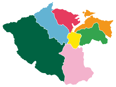
模板:Location map Taiwan Keelung
| 名稱 | 基隆市 | |||
|---|---|---|---|---|
| 邊界坐標 | ||||
| 25.17 | ||||
| 121.63 | ←↕→ | 121.81 | ||
| 25.05 | ||||
| 地圖中心 | 25°07′N 121°43′E / 25.11°N 121.72°E | |||
| 圖像 | Districts of Keelung-Taiwan.svg | |||

| ||||
| 附加圖像㈡ | Keelung districts map.svg | |||

| ||||
| 上述文件嵌入自Template:Location map Taiwan Keelung/doc。 (編輯 | 歷史) 編者可以在本模板的沙盒 (建立 | 鏡像)和測試樣例 (建立)頁面進行實驗。 請在/doc子頁面中添加分類。本模板的子頁面。 |