蘭松國家公園
蘭松國家公園(泰語:อุทยานแห่งชาติแหลมสน,皇家轉寫:Uthayan Haeng Chat Laem Son)位於泰國南部拉廊府與攀牙府,面向安達曼海,成立於1983年,面積315平方公里(122平方英里)。
| 蘭松國家公園 | |
|---|---|
 蘭松國家公園 | |
 蘭松國家公園在泰國的位置 | |
| 位置 | 泰國拉廊府、攀牙府 |
| 坐標 | 9°36′14″N 98°27′58″E / 9.604°N 98.466°E座標:9°36′14″N 98°27′58″E / 9.604°N 98.466°E |
| 面積 | 315平方公里(122平方英里) |
| 建立 | 1983年8月19日 |
| 主管團體 | 國家公園、野生動物和植物保護局(DNP) |
| 官方名稱 | Kaper Estuary - Laemson Marine National Park - Kraburi Estuary |
| 評定時間 | 2002年8月14日 |
| 參考編碼 | 1183 |
概要 編輯
蘭松國家公園位於拉廊南方約60公里(37英里)處[1]:57[2]:109,在安達曼海邊有長達100公里(62英里)海岸,是泰國最長的受保護海岸[3]:638。公園的名稱以沿岸有整排的松樹而得名[4]:104。
蘭松國家公園位於海岸地區,包括海灘、珊瑚礁、紅樹林沼澤、熱帶雨林。公園成立於1983年8月19日[5],2002年被指定為拉姆薩爾公約的保護區[6]。2004年印度洋大地震時,蘭松國家公園的管理處被海嘯夷為平地[7]:17。
圖集 編輯
-
 公園內景觀
公園內景觀 -
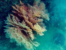 公園內的粉紅色珊瑚礁
 -
 公園內的食蟹獼猴


旅遊 編輯
蘭松國家公園內有多個有白色細砂的沙灘,也有數個離島可搭船造訪。從拉廊有公路可抵達,路程約90公里(56英里)。公園有許多鳥類棲息,適合賞鳥。公園管理局建議最佳旅遊季節為五月至八月,入場費為大人200泰銖,兒童100泰銖。[5]
參考資料 編輯
- ^ Susan M. Braatz. Conserving biological diversity: a strategy for protected areas in the Asia-Pacific region. World Bank Publications. 1992-11. ISBN 978-0-8213-2307-6.
- ^ John Hoskin. Thailand. New Holland Publishers. 2006-10. ISBN 978-1-84537-549-2.
- ^ China Williams. Thailand. Lonely Planet. 2009-08-01. ISBN 978-1-74179-157-0.
- ^ James Burrill Angell. Water is the Animal: Fin de Millenaire Reflections of Planet Earth from a Diplomatic Courier. iUniverse. 2000-12. ISBN 978-0-595-15423-4.
- ^ 5.0 5.1 Laem Son National Park. amazing Thailand. Tourism Authority of Thailand. [2022-04-26]. (原始內容存檔於2021-01-20).
- ^ Kaper Estuary - Laemson Marine National Park - Kraburi Estuary. Ramsar Sites Information Service. [2022-04-26]. (原始內容存檔於2023-05-29).
- ^ Somrudee Meprasert. The 2004 Indian Ocean tsunami: Tourism impacts and recovery progress in Thailand's marine national parks. Oregon State University. 2006. ISBN 978-0-542-96361-2.
- ^ The Andaman Sea Nature Reserves of Thailand. 聯合國教科文組織. [2022-04-18]. (原始內容存檔於2022-01-13) (英語).
外部連結 編輯
- (英文)泰國觀光局-蘭松國家公園 (頁面存檔備份,存於互聯網檔案館)