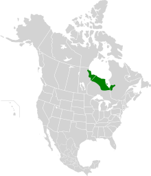
哈德逊湾低地
哈德逊湾低地(英語:Hudson Bay Lowlands)是位于加拿大地盾、哈德逊湾和詹姆斯湾南岸之间的一个广阔湿地,是加拿大最大的湿地,也是世界上最大的湿地之一[1]。该低地的大部分位于加拿大安大略省,還有一部分位於曼尼托巴省和魁北克省[2]

參考資料
编辑外部連結
编辑54°45′N 83°00′W / 54.750°N 83.000°W
- Map of the Hudson Plains Ecoregions(页面存档备份,存于互联网档案馆)
- An Introduction to Ecozones(页面存档备份,存于互联网档案馆)
- Map of major rivers draining into southern Hudson Bay(页面存档备份,存于互联网档案馆)
- Hudson Bay Lowlands - Ontario Ministry of Natural Resources(页面存档备份,存于互联网档案馆)
- Proposed protected areas in Manitoba.(页面存档备份,存于互联网档案馆)
- Hudson Bay in The Canadian Encyclopedia(页面存档备份,存于互联网档案馆)
- Hudson Bay Lowlands - Ottertooth(页面存档备份,存于互联网档案馆)
- Arctic Institute paper by Hugo Sjörs, Bogs and Fens in the Hudson Bay Lowlands.
- Hudson Bay Lowlands show recent effects of global warming. Max Paris Environment Unit, CBC News. 8 October 2013 [2013-10-08]. (原始内容存档于2017-07-28).