File:AncientEgyptJamesRennell01.jpg

本预览的尺寸:541 × 599像素。 其他分辨率:217 × 240像素 | 433 × 480像素 | 693 × 768像素 | 924 × 1,024像素 | 1,548 × 1,715像素。
原始文件 (1,548 × 1,715像素,文件大小:384 KB,MIME类型:image/jpeg)
摘要
| 描述 |
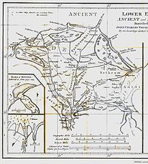
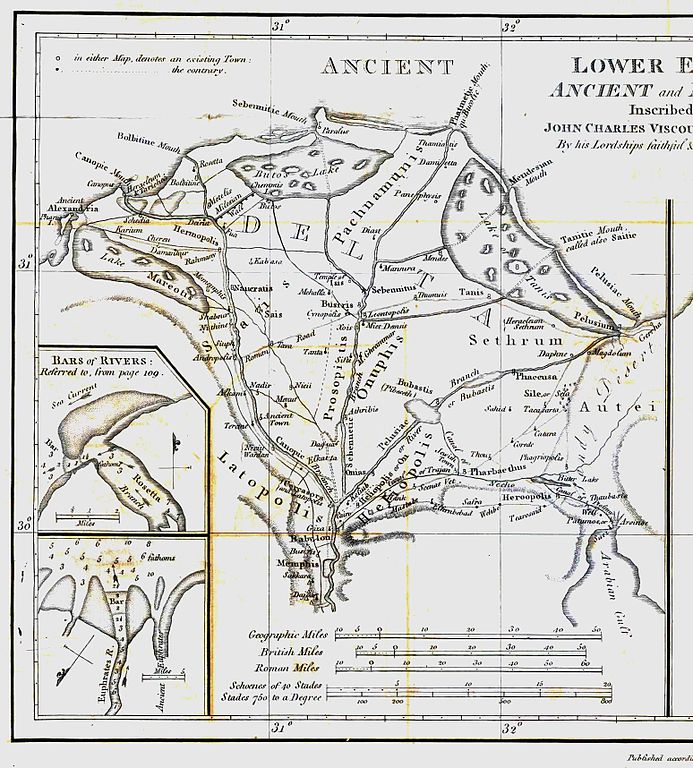
English: Map of ancient Egypt created by James Rennell as an insert for his book "The geographical system of Herodotus examined and explained" (published 1800 and 1830). This map shows Rennell's understanding of the geography of Egypt's Nile delta during the Greek Classical period (510 BC - 323 BC) based on the writings of Herodotus (484 BC - 425 BC). |
| 日期 | |
| 来源 | Book "The geographical system of Herodotus examined and explained", by James Rennell (published 1800 and 1830). |
| 作者 | Carl Drews scanned the map and enhanced the color contrast. |
许可协议
|
本作品在其来源国以及其他著作权期限是作者逝世后100年或以下的国家和地区属于公有领域。 | |
| 本文件已被确认为免除已知的著作权法限制(包括所有相关权利)。 | |
文件历史
点击某个日期/时间查看对应时刻的文件。
| 日期/时间 | 缩略图 | 大小 | 用户 | 备注 | |
|---|---|---|---|---|---|
| 当前 | 2010年8月12日 (四) 19:23 | | 1,548 × 1,715(384 KB) | CarlDrews~commonswiki | {{Information |Description={{en|1=Map of ancient Egypt created by James Rennell as an insert for his book "The geographical system of Herodotus examined and explained" (published 1800 and 1830). This map shows Rennell's understanding of the geography of E |
文件用途
以下页面使用本文件:
全域文件用途
以下其他wiki使用此文件:
- ar.wikipedia.org上的用途
- bg.wikipedia.org上的用途
- de.wikipedia.org上的用途
- el.wikipedia.org上的用途
- en.wikipedia.org上的用途
- es.wikipedia.org上的用途
- fr.wikipedia.org上的用途
- he.wikipedia.org上的用途
- ja.wikipedia.org上的用途
- ja.wikibooks.org上的用途
- nl.wikipedia.org上的用途
- sl.wikipedia.org上的用途
- uk.wikipedia.org上的用途