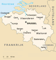
File:Be-map-nl.png
Be-map-nl.png (347 × 373像素,文件大小:73 KB,MIME类型:image/png)
文件历史
点击某个日期/时间查看对应时刻的文件。
| 日期/时间 | 缩略图 | 大小 | 用户 | 备注 | |
|---|---|---|---|---|---|
| 当前 | 2019年2月11日 (一) 14:07 |  | 347 × 373(73 KB) | HerrAdams | Cropped 1 % horizontally, 1 % vertically using CropTool with precise mode. Removed border. |
| 2019年2月7日 (四) 21:21 |  | 351 × 377(60 KB) | Le Fou | Zeebrugge is geen stad, maar onderdeel van de stad Brugge. | |
| 2007年2月15日 (四) 19:58 |  | 351 × 377(63 KB) | Wester | == Summary == {{en|The french version of a Belgium's map, converted directly from a map in GIF format from the CIA World Factbook.</br> Translation by Westemarck}} == Licensing == {{PD-USGov-CIA-WF}} [[Categ |
文件用途
以下页面使用本文件:
全域文件用途
以下其他wiki使用此文件:
- af.wikipedia.org上的用途
- ff.wikipedia.org上的用途
- io.wikipedia.org上的用途
- li.wikibooks.org上的用途
- nds-nl.wikipedia.org上的用途
- nl.wikipedia.org上的用途
- nl.wikibooks.org上的用途
- pdc.wikipedia.org上的用途
- to.wikipedia.org上的用途
- trv.wikipedia.org上的用途
- vls.wikipedia.org上的用途
- zea.wikipedia.org上的用途


