File:Be-map.png
Be-map.png (559 × 600像素,文件大小:176 KB,MIME类型:image/png)
文件历史
点击某个日期/时间查看对应时刻的文件。
| 日期/时间 | 缩略图 | 大小 | 用户 | 备注 | |
|---|---|---|---|---|---|
| 当前 | 2020年4月13日 (一) 21:48 |  | 559 × 600(176 KB) | Le Fou | Zeebrugge is not a city, but part of the city of Bruges. |
| 2018年7月21日 (六) 19:13 | 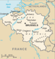 | 1,024 × 1,099(24 KB) | Karel Adriaan | Resized to 1024 | |
| 2007年4月20日 (五) 20:48 |  | 328 × 353(12 KB) | Tene~commonswiki | Optimised (0) | |
| 2007年3月11日 (日) 17:07 |  | 328 × 353(13 KB) | Feydey | 2007 factbook map | |
| 2006年5月27日 (六) 13:55 |  | 329 × 353(20 KB) | Matt314 | "Redu" in the same font size as the other cities | |
| 2006年4月7日 (五) 20:59 |  | 329 × 353(20 KB) | Abrev | Map of Belgium Updated version uploaded by [http://de.wikipedia.org/wiki/Benutzer:Tzzzpfff]. No rights reserved for updating. | |
| 2006年1月5日 (四) 16:46 |  | 330 × 355(9 KB) | Jrenier | Reverted to earlier revision | |
| 2006年1月5日 (四) 16:35 |  | 330 × 355(9 KB) | Jrenier | Reverted to earlier revision | |
| 2006年1月3日 (二) 19:53 |  | 330 × 355(28 KB) | Iunity | ||
| 2004年11月27日 (六) 19:24 |  | 330 × 355(9 KB) | Kneiphof | Map of Belgium, CIA factbook (taken from EN Wikipedia) |
文件用途
以下2个页面使用本文件:
全域文件用途
以下其他wiki使用此文件:
- als.wikipedia.org上的用途
- ay.wikipedia.org上的用途
- azb.wikipedia.org上的用途
- az.wikipedia.org上的用途
- bcl.wikipedia.org上的用途
- be-tarask.wikipedia.org上的用途
- bg.wiktionary.org上的用途
- bn.wikipedia.org上的用途
- bs.wikipedia.org上的用途
- ca.wikipedia.org上的用途
- de.wikipedia.org上的用途
- de.wikinews.org上的用途
- dsb.wikipedia.org上的用途
- en.wikipedia.org上的用途
- en.wikinews.org上的用途
- en.wikivoyage.org上的用途
- en.wiktionary.org上的用途
- es.wikipedia.org上的用途
- fa.wikipedia.org上的用途
- fi.wikipedia.org上的用途
- fr.wikipedia.org上的用途
- fr.wikinews.org上的用途
- gag.wikipedia.org上的用途
- ga.wikipedia.org上的用途
- gl.wikipedia.org上的用途
- ha.wikipedia.org上的用途
- hi.wikipedia.org上的用途
- hy.wikipedia.org上的用途
- incubator.wikimedia.org上的用途
- io.wikipedia.org上的用途
查看此文件的更多全域用途。


