File:Beacon Hill Gloucester locator map.png
此为最大尺寸。
Beacon_Hill_Gloucester_locator_map.png (356 × 296像素,文件大小:6 KB,MIME类型:image/png)
- Author: en:User:Earl Andrew
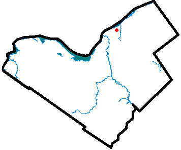
- Description: Locator map of Beacon Hill, a neighbourhood of Gloucester, Ontario, part of Ottawa, Ontario.
- Source: Uploaded as en:Image:Beaconhillgloucester.PNG on January 31 2005
Note: This tag is deprecated, please replace this template with {{PD-user-w}}
| |
本作品已被作者英语维基百科项目的Earl Andrew释出到公有领域。这适用于全世界。 如果这样做不合法的话: |
文件历史
点击某个日期/时间查看对应时刻的文件。
| 日期/时间 | 缩略图 | 大小 | 用户 | 备注 | |
|---|---|---|---|---|---|
| 当前 | 2006年4月5日 (三) 22:50 | 356 × 296(6 KB) | Jkelly | *Author: en:User:Earl Andrew *Description: Locator map of Beacon Hill, a neighbourhood of Gloucester, Ontario, part of Ottawa, Ontario. *Source: Uploaded as en:Image:Beaconhillgloucester.PNG on January 31 2005 {{PD-user-wikimedia|E |
文件用途
以下页面使用本文件:
全域文件用途
以下其他wiki使用此文件:
- en.wikipedia.org上的用途
- www.wikidata.org上的用途