File:Boerderij Commissieweg de Wijk.jpg
本预览的尺寸:790 × 599像素。 其他分辨率:316 × 240像素 | 633 × 480像素 | 1,012 × 768像素 | 1,144 × 868像素。
原始文件 (1,144 × 868像素,文件大小:149 KB,MIME类型:image/jpeg)
|
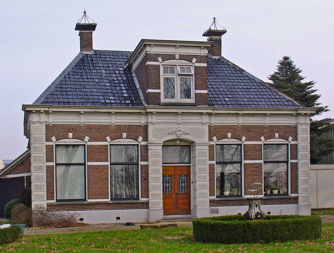
This is an image of rijksmonument number 507395 Information from structured data: |
摘要
| 描述 |
Nederlands: monumentale boerderij aan de Commissieweg in de Wijk |
| 日期 | |
| 来源 | 自己的作品 |
| 作者 | Gouwenaar |
| 物体位置 | | 在以下服务上查看本图像和附近其他图像: OpenStreetMap |
|---|
许可协议
| 我,本作品著作权人,释出本作品至公有领域。这适用于全世界。 在一些国家这可能不合法;如果是这样的话,那么: 我无条件地授予任何人以任何目的使用本作品的权利,除非这些条件是法律规定所必需的。 |
文件历史
点击某个日期/时间查看对应时刻的文件。
| 日期/时间 | 缩略图 | 大小 | 用户 | 备注 | |
|---|---|---|---|---|---|
| 当前 | 2010年3月24日 (三) 21:16 | | 1,144 × 868(149 KB) | Gouwenaar | {{Information |Description={{nl|monumentale boerderij aan de Commissieweg in de Wijk}} |Source={{own}} |Date=2010-03-24 |Author=Gouwenaar |Permission= |other_versions= }} Category:Buildings in Drenthe |
文件用途
以下页面使用本文件:
全域文件用途
以下其他wiki使用此文件:
- ar.wikipedia.org上的用途
- br.wikipedia.org上的用途
- ca.wikipedia.org上的用途
- ceb.wikipedia.org上的用途
- en.wikipedia.org上的用途
- eu.wikipedia.org上的用途
- fa.wikipedia.org上的用途
- ga.wikipedia.org上的用途
- hu.wikipedia.org上的用途
- it.wikipedia.org上的用途
- ku.wikipedia.org上的用途
- ms.wikipedia.org上的用途
- nl.wikipedia.org上的用途
- pl.wikipedia.org上的用途
- pt.wikipedia.org上的用途
- ro.wikipedia.org上的用途
- ru.wikipedia.org上的用途
- simple.wikipedia.org上的用途
- sv.wikipedia.org上的用途
- uk.wikipedia.org上的用途
- vec.wikipedia.org上的用途
- vi.wikipedia.org上的用途
- vo.wikipedia.org上的用途
- www.wikidata.org上的用途
- zh-min-nan.wikipedia.org上的用途