File:Canada labelled map.svg

此SVG文件的PNG预览的大小:619 × 600像素。 其他分辨率:248 × 240像素 | 496 × 480像素 | 793 × 768像素 | 1,057 × 1,024像素 | 2,114 × 2,048像素 | 1,304 × 1,263像素。
原始文件 (SVG文件,尺寸为1,304 × 1,263像素,文件大小:123 KB)
| 描述 |
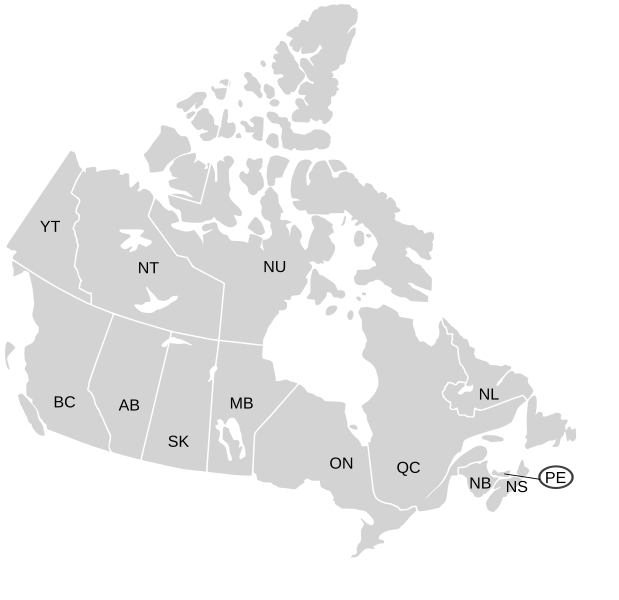
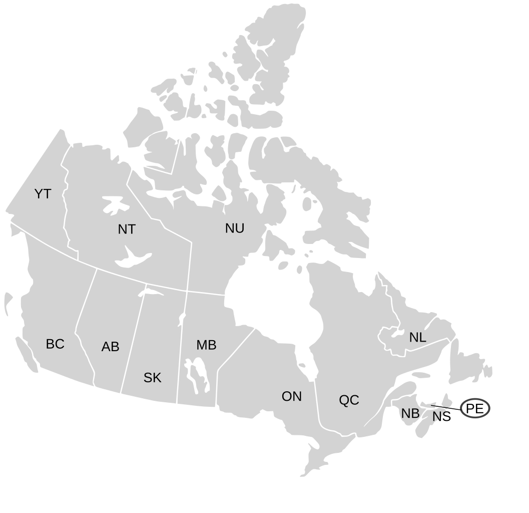
English: SVG map of Canada labelled with province names
Non-contiguous parts of a states/provinces are "grouped" together with the main area of the state/provinces, so any state/provinces can be coloured in completion with one click anywhere on the state/provinces's area. Also, all states/provinces have a "id" attached to them, making them easy to find. Select "find" and then enter in the state/provinces's ISO 3166-2 code in the "id" field to find it. The codes can be found here (Canada) and here (USA). |
| 日期 | 03-07-2007 edited 8-Aug-2007 |
| 来源 |
|
| 作者 | Lokal_Profil image cut to remove Canada and move Alaska closer by Paul Robinson |
| 授权 (二次使用本文件) |
本文件采用知识共享署名-相同方式共享 2.5 通用许可协议授权。
|
| 其他版本 |
Labelled US map.svg same map with state labels, Blank US Map.svg similar map with inset versions of Alaska and Hawaii (as opposed to actual size, which is what appears here) Original blank map of USA and Canada, That image with labels, Original USA/Canada map with labels, Canada blank map.svg blank map of Canada |
文件历史
点击某个日期/时间查看对应时刻的文件。
| 日期/时间 | 缩略图 | 大小 | 用户 | 备注 | |
|---|---|---|---|---|---|
| 当前 | 2009年1月7日 (三) 19:07 | | 1,304 × 1,263(123 KB) | Lokal Profil | Fixed NS (Nova Scotia) / NB (New Brunswick) issue |
| 2007年8月9日 (四) 21:20 |  | 1,304 × 1,263(123 KB) | Rfc1394 | {{Information |Description={{en|SVG map of Canada labelled with province names}} Non-contiguous parts of a states/provinces are "grouped" together with the main area of the state/provinces, so any state/provinces can be coloured in completion with one cli |
文件用途
以下页面使用本文件:
全域文件用途
以下其他wiki使用此文件:
- ca.wikipedia.org上的用途
- en.wikipedia.org上的用途
- eo.wikipedia.org上的用途
- es.wikipedia.org上的用途
- ja.wikipedia.org上的用途
- lt.wikipedia.org上的用途
- mk.wikipedia.org上的用途
- no.wikipedia.org上的用途
- sv.wikipedia.org上的用途
- tr.wikipedia.org上的用途
- zh-min-nan.wikipedia.org上的用途