File:EB9 Corea.png

本预览的尺寸:432 × 599像素。 其他分辨率:173 × 240像素 | 346 × 480像素 | 554 × 768像素 | 738 × 1,024像素 | 2,548 × 3,534像素。
原始文件 (2,548 × 3,534像素,文件大小:4.75 MB,MIME类型:image/png)
摘要
| 描述 |
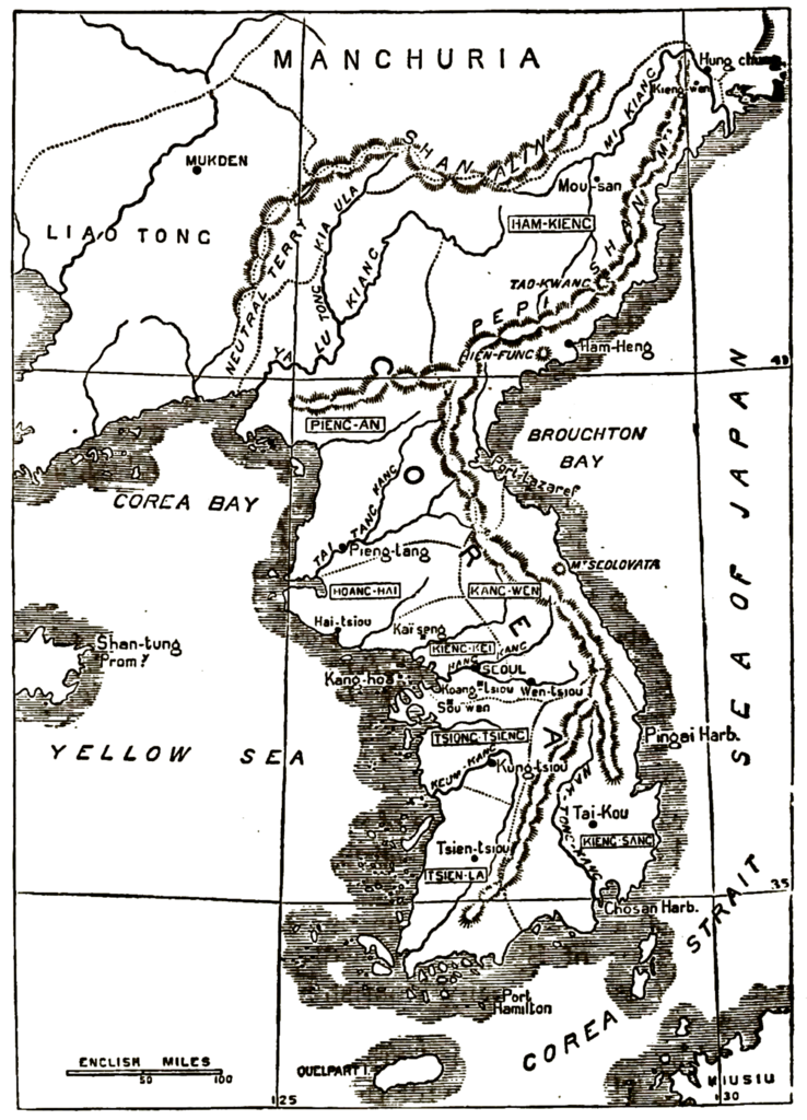
English: "Sketch Map of Corea": a map of Korea from the 9th edition of the Encyclopaedia Britannica.
The map misplaces Hamhung on Iwon Bay and includes two mountains given by their Chinese names—equivalent to Xianfeng and Daoguang—which do not exist in any way, shape, or form and are apparently the result of mistaken measurements undertaken by the Russian frigate Pallada and the French frigate Virginie in the 1850s. |
| 日期 | |
| 来源 | "Corea" in the Encyclopaedia Britannica, 9th ed., Vol. VI, p. 390. |
| 作者 | Anonymous but presumably the firm of William & Alexander Keith Johnston or of John Bartholomew & Son. |
许可协议
|
公有领域作品必须在美国以及来源国没有版权问题,才能上传至维基共享资源。如果此作品不是美国作品,这个文件必须要有一个额外的版权标记显示此文件在来源国的版权状态。
注意:此标签不应用于录音作品。 |
| 註解 | 該圖片含有註解:在維基媒體共享資源上查看註解 |
文件历史
点击某个日期/时间查看对应时刻的文件。
| 日期/时间 | 缩略图 | 大小 | 用户 | 备注 | |
|---|---|---|---|---|---|
| 当前 | 2017年5月6日 (六) 15:57 | | 2,548 × 3,534(4.75 MB) | LlywelynII | User created page with UploadWizard |
文件用途
以下页面使用本文件:
全域文件用途
以下其他wiki使用此文件:
- en.wikipedia.org上的用途
- en.wikisource.org上的用途
- it.wikipedia.org上的用途