File:Elysium MOLA zoom 64.jpg

本预览的尺寸:796 × 600像素。 其他分辨率:319 × 240像素 | 637 × 480像素 | 1,019 × 768像素 | 1,280 × 965像素 | 2,560 × 1,930像素 | 2,940 × 2,216像素。
原始文件 (2,940 × 2,216像素,文件大小:2.29 MB,MIME类型:image/jpeg)
摘要
| 描述 |
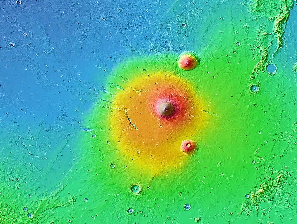
English: A colorized topographic map of the volcanic province Elysium, together with its surroundings, from the Mars Orbiter Laser Altimeter (MOLA) instrument of the Mars Global Surveyor spacecraft. Elysium, in the eastern hemisphere of Mars, is the second largest volcanic region on the planet, after Tharsis. The largest shield volcano, Elysium Mons, is at center, while the smaller volcanoes Hecates Tholus and Albor Tholus are to the former's upper and lower right, respectively. Some of the features in this image are annotated in Wikimedia Commons. |
| 日期 | |
| 来源 | JMARS |
| 作者 | NASA / JPL-Caltech / Arizona State University |
| 其他版本 |

|

许可协议
| 本文件完全由NASA创作,在美国属于公有领域。根据NASA的版权方针,NASA的材料除非另有声明否则不受版权保护。(参见Template:PD-USGov/zh、NASA版权方针页面或JPL图片使用方针。) | ||
 |
警告:
|
| 註解 | 該圖片含有註解:在維基媒體共享資源上查看註解 |
文件历史
点击某个日期/时间查看对应时刻的文件。
| 日期/时间 | 缩略图 | 大小 | 用户 | 备注 | |
|---|---|---|---|---|---|
| 当前 | 2013年7月29日 (一) 07:30 | | 2,940 × 2,216(2.29 MB) | WolfmanSF | User created page with UploadWizard |
文件用途
以下页面使用本文件:
全域文件用途
以下其他wiki使用此文件:
- en.wikipedia.org上的用途
- fa.wikipedia.org上的用途
- fr.wikipedia.org上的用途
- hr.wikipedia.org上的用途
- pl.wikipedia.org上的用途
- uk.wikipedia.org上的用途