File:Estuaries, Northwest Coast of Madagascar.JPG
本预览的尺寸:398 × 599像素。 其他分辨率:159 × 240像素 | 319 × 480像素 | 510 × 768像素 | 680 × 1,024像素 | 1,360 × 2,048像素 | 2,848 × 4,288像素。
原始文件 (2,848 × 4,288像素,文件大小:13.29 MB,MIME类型:image/jpeg)
摘要
| 描述 |
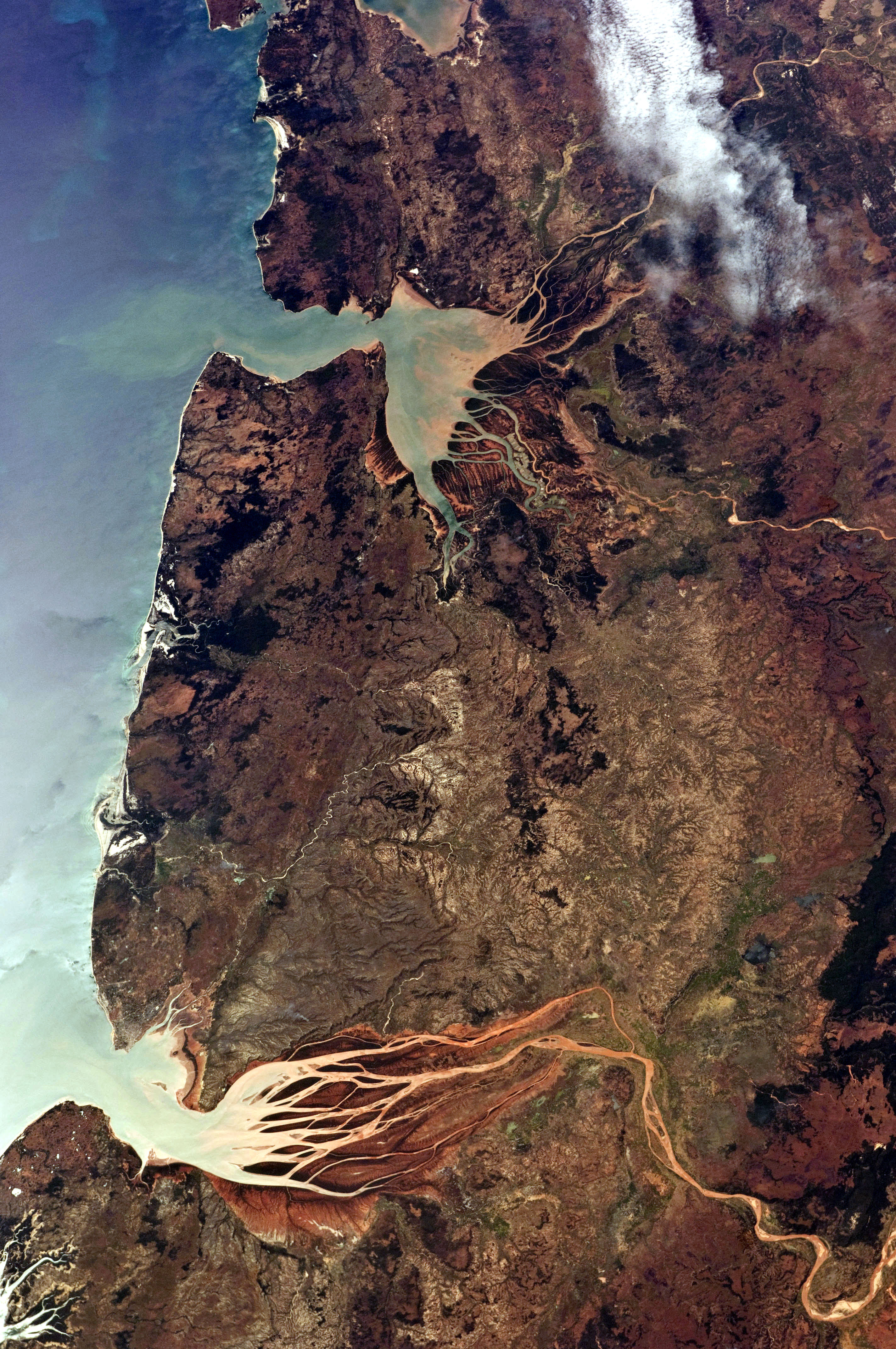
English: This astronaut photograph, taken from the International Space Station, highlights two estuaries along the north-western coastline of Madagascar. Bombetoka Bay (image upper left) is fed by the Betsiboka River, and is a frequent subject of astronaut photography due to its striking red floodplain sediments. Mahajamba Bay (image right) is fed by several rivers, including the Mahajamba and Sofia. |
| 日期 | |
| 来源 | NASA Earth Observatory |
| 作者 | ISS Astronaut photograph |
| 相机位置 | | 在以下服务上查看本图像和附近其他图像: OpenStreetMap |
|---|
本图像或视频收录于美国国家航空航天局 (NASA)休斯顿太空中心(Johnson Space Center),其照片编号是: ISS028-E-6687 此标签不表示文件的著作权状态。任何文件在附有此标签的同時还需要一个有效的著作权标签。请参阅许可协议说明页面以了解更多信息。 其他语言:
|
许可协议
| 本文件完全由NASA创作,在美国属于公有领域。根据NASA的版权方针,NASA的材料除非另有声明否则不受版权保护。(参见Template:PD-USGov/zh、NASA版权方针页面或JPL图片使用方针。) | ||
 |
警告:
|
| 註解 | 該圖片含有註解:在維基媒體共享資源上查看註解 |
文件历史
点击某个日期/时间查看对应时刻的文件。
| 日期/时间 | 缩略图 | 大小 | 用户 | 备注 | |
|---|---|---|---|---|---|
| 当前 | 2021年5月16日 (日) 08:00 | | 2,848 × 4,288(13.29 MB) | SteinsplitterBot | Bot: Image rotated by 270° |
| 2011年6月13日 (一) 11:30 |  | 4,288 × 2,848(13.3 MB) | Originalwana | {{Information |Description ={{en|1=This astronaut photograph, taken from the International Space Station, highlights two estuaries along the north-western coastline of Madagascar. Bombetoka Bay (image upper left) is fed by the [[:Category:Betsiboka |
文件用途
以下页面使用本文件:
全域文件用途
以下其他wiki使用此文件:
- de.wikipedia.org上的用途
- en.wikipedia.org上的用途
- et.wikipedia.org上的用途
- fr.wikipedia.org上的用途
- ha.wikipedia.org上的用途
- mg.wikipedia.org上的用途
- ml.wikipedia.org上的用途
- nl.wikipedia.org上的用途
- pl.wikipedia.org上的用途
- pt.wikipedia.org上的用途
- ro.wikipedia.org上的用途
- ru.wikipedia.org上的用途
- sh.wikipedia.org上的用途
- sl.wikipedia.org上的用途
- sr.wikipedia.org上的用途