File:George Town Harbour.jpg
本预览的尺寸:800 × 376像素。 其他分辨率:320 × 150像素 | 640 × 301像素 | 1,024 × 481像素 | 1,650 × 775像素。
原始文件 (1,650 × 775像素,文件大小:365 KB,MIME类型:image/jpeg)
摘要
| 描述 |
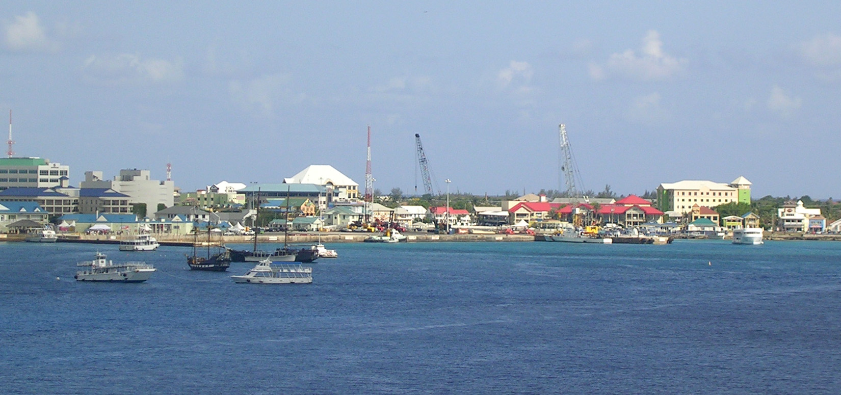
The harbor area of George Town, Grand Cayman, from our cruise ship before our departure. The National Museum is the building with a red roof in the center, just right of the tall, black crane. Our tender landed at the far left, or possibly just to the left of that. The glass bottom boat's home base may be the small green-roofed building in fromt of the large building at the right. The cluster of small ships at the left includes the two "pirate ship" party boats, a George Town tender, and one that I cannot identify at the left. This is not a real panorama, but a single photo with excess sky and water cropped out. |
| 日期 | |
| 来源 |
George Town - Panorama from Cruise Ship
|
| 作者 | Roger Wollstadt from Sarasota, Florida |
| 相机位置 | | 在以下服务上查看本图像和附近其他图像: OpenStreetMap |
|---|
许可协议
本文件采用知识共享署名-相同方式共享 2.0 通用许可协议授权。
- 您可以自由地:
- 共享 – 复制、发行并传播本作品
- 修改 – 改编作品
- 惟须遵守下列条件:
- 署名 – 您必须对作品进行署名,提供授权条款的链接,并说明是否对原始内容进行了更改。您可以用任何合理的方式来署名,但不得以任何方式表明许可人认可您或您的使用。
- 相同方式共享 – 如果您再混合、转换或者基于本作品进行创作,您必须以与原先许可协议相同或相兼容的许可协议分发您贡献的作品。
| 此张图片原发布于Flickr,在2012年5月24日由管理员或审查员File Upload Bot (Magnus Manske)检查后,确认检查时图片在Flickr的版权声明与维基共享资源的版权使用方针相符。 |
文件历史
点击某个日期/时间查看对应时刻的文件。
| 日期/时间 | 缩略图 | 大小 | 用户 | 备注 | |
|---|---|---|---|---|---|
| 当前 | 2012年5月24日 (四) 19:29 | | 1,650 × 775(365 KB) | File Upload Bot (Magnus Manske) | Transferred from Flickr by User:AnonyLog using flickr2commons |
文件用途
以下页面使用本文件:
全域文件用途
以下其他wiki使用此文件:
- de.wikipedia.org上的用途
- en.wikipedia.org上的用途
- gl.wikipedia.org上的用途
- he.wikivoyage.org上的用途
- hr.wikipedia.org上的用途
- hy.wikipedia.org上的用途
- io.wikipedia.org上的用途