File:Jefferson north of Orange, Cromwell.jpg

本预览的尺寸:800 × 532像素。 其他分辨率:320 × 213像素 | 640 × 426像素 | 1,024 × 681像素 | 1,280 × 851像素 | 2,560 × 1,702像素 | 6,016 × 4,000像素。
原始文件 (6,016 × 4,000像素,文件大小:6.12 MB,MIME类型:image/jpeg)
| 相机位置 | | 在以下服务上查看本图像和附近其他图像: OpenStreetMap |
|---|
| 描述 |
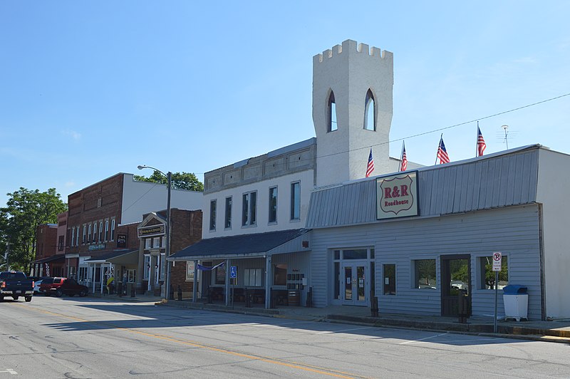
English: Buildings on the eastern side of Jefferson Street (State Road 5) just north of Orange Street in Cromwell, Indiana, United States. This block is part of the Cromwell Historic District, a historic district that is listed on the National Register of Historic Places.
|
||
| 日期 | 摄于2016年7月23日 | ||
| 来源 | 自己的作品 | ||
| 作者 | Nyttend | ||
| 授权 (二次使用本文件) |
|
文件历史
点击某个日期/时间查看对应时刻的文件。
| 日期/时间 | 缩略图 | 大小 | 用户 | 备注 | |
|---|---|---|---|---|---|
| 当前 | 2016年8月16日 (二) 18:02 | | 6,016 × 4,000(6.12 MB) | Nyttend | {{Location|41|24|4|N|85|36|54|W}} {{Information |Description={{en|Buildings on the eastern side of Jefferson Street ({{w|Indiana State Road 5|State Road 5}}) just north of Orange Street in {{w|Cromwell, Indiana|Cromwell}}, {{w|Indiana}}, {{w|United Sta... |
文件用途
以下页面使用本文件:
全域文件用途
以下其他wiki使用此文件:
- ar.wikipedia.org上的用途
- arz.wikipedia.org上的用途
- ca.wikipedia.org上的用途
- ceb.wikipedia.org上的用途
- ce.wikipedia.org上的用途
- en.wikipedia.org上的用途
- es.wikipedia.org上的用途
- eu.wikipedia.org上的用途
- ht.wikipedia.org上的用途
- it.wikipedia.org上的用途
- lld.wikipedia.org上的用途
- no.wikipedia.org上的用途
- pl.wikipedia.org上的用途
- pt.wikipedia.org上的用途
- sr.wikipedia.org上的用途
- tt.wikipedia.org上的用途
- uk.wikipedia.org上的用途
- uz.wikipedia.org上的用途
- www.wikidata.org上的用途