File:Kyoto-Nara Railway Line Map.jpg
本预览的尺寸:211 × 599像素。 其他分辨率:84 × 240像素 | 169 × 480像素 | 270 × 768像素 | 360 × 1,024像素 | 1,429 × 4,060像素。
原始文件 (1,429 × 4,060像素,文件大小:1.37 MB,MIME类型:image/jpeg)
摘要
| 描述 |
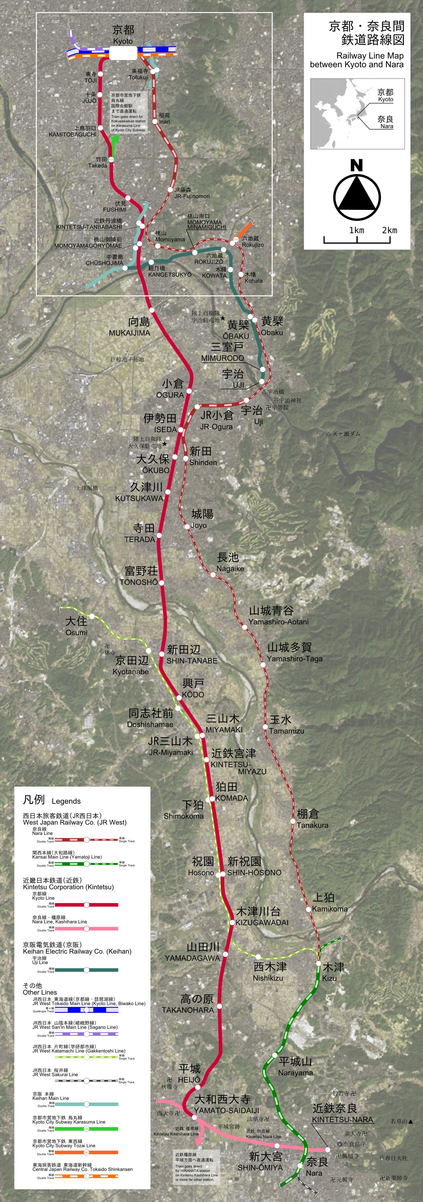
English: This is the Railway Line Map between Kyoto and Nara in Japan. This is the raster image version.
日本語: 京都・奈良間鉄道路線図。ラスター画像版。 |
| 日期 | |
| 来源 | This has a sattelite image based by LANDSAT remote sensing data. |
| 作者 | excl-zoo |
| 其他版本 |
Image:Kyoto-Nara_Railway_Line_Map.svg Image:Kyoto-Fushimi_Railway_Line_Map.svg, Image:Kyoto-Fushimi_Railway_Line_Map.jpg |
许可协议
| 我,本作品著作权人,释出本作品至公有领域。这适用于全世界。 在一些国家这可能不合法;如果是这样的话,那么: 我无条件地授予任何人以任何目的使用本作品的权利,除非这些条件是法律规定所必需的。 |
文件历史
点击某个日期/时间查看对应时刻的文件。
| 日期/时间 | 缩略图 | 大小 | 用户 | 备注 | |
|---|---|---|---|---|---|
| 当前 | 2007年5月28日 (一) 13:22 | 1,429 × 4,060(1.37 MB) | Excl-zoo | {{Information |Description= |Source= |Date= |Author= |Permission= |other_versions= }} | |
| 2007年5月27日 (日) 10:48 | 1,429 × 4,060(1.36 MB) | Excl-zoo | {{Information |Description= |Source= |Date= |Author= |Permission= |other_versions= }} | ||
| 2007年5月27日 (日) 05:08 | 1,429 × 4,060(1.36 MB) | Excl-zoo | {{Information |Description= |Source= |Date= |Author= |Permission= |other_versions= }} | ||
| 2007年5月26日 (六) 20:27 | 1,429 × 4,059(882 KB) | Excl-zoo | {{Information |Description=This is the Railway Line Map between Kyoto and Nara in Japan. This is the raster image version.<br />'''ja: '''<span style="" lang="ja">京都・奈良間鉄道路線図。ラスター画像版。</span> |Source=This has a satte |
文件用途
全域文件用途
以下其他wiki使用此文件:
- fr.wikipedia.org上的用途
- it.wikipedia.org上的用途
- ja.wikipedia.org上的用途
- nl.wikipedia.org上的用途
- www.wikidata.org上的用途