File:Lundy outline map.png

本预览的尺寸:504 × 600像素。 其他分辨率:202 × 240像素 | 600 × 714像素。
原始文件 (600 × 714像素,文件大小:425 KB,MIME类型:image/png)
文件历史
点击某个日期/时间查看对应时刻的文件。
| 日期/时间 | 缩略图 | 大小 | 用户 | 备注 | |
|---|---|---|---|---|---|
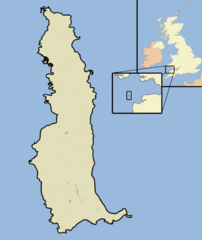
| 当前 | 2007年10月17日 (三) 22:46 | | 600 × 714(425 KB) | Jza84 | {{Information |Description=A map of the Island of Lundy, in the English Channel, part of the United Kingdom |Source=self-made, using Adobe Illustrator and Photoshop |Date=October 2007 |Author= Jhamez84 }} |
文件用途
以下页面使用本文件:
全域文件用途
以下其他wiki使用此文件:
- ar.wikipedia.org上的用途
- ca.wikipedia.org上的用途
- cs.wikipedia.org上的用途
- de.wikipedia.org上的用途
- en.wikipedia.org上的用途
- en.wikivoyage.org上的用途
- eo.wikipedia.org上的用途
- es.wikipedia.org上的用途
- eu.wikipedia.org上的用途
- fi.wikipedia.org上的用途
- fr.wikipedia.org上的用途
- fr.wiktionary.org上的用途
- ga.wikipedia.org上的用途
- it.wikipedia.org上的用途
- ja.wikipedia.org上的用途
- ko.wikipedia.org上的用途
- pl.wikipedia.org上的用途
- pt.wikipedia.org上的用途
- ru.wikipedia.org上的用途
- sco.wikipedia.org上的用途
- uk.wikipedia.org上的用途
- www.wikidata.org上的用途