File:Map of federal subjects of Russia (2014), disputed Crimea.svg

此SVG文件的PNG预览的大小:512 × 282像素。 其他分辨率:320 × 176像素 | 640 × 353像素 | 1,024 × 564像素 | 1,280 × 705像素 | 2,560 × 1,410像素。
原始文件 (SVG文件,尺寸为512 × 282像素,文件大小:723 KB)
,_disputed_Crimea.svg?uselang=zh)
,_disputed_Crimea.svg?uselang=zh)
,_disputed_Crimea.svg?action=history&uselang=zh)
,_disputed_Crimea.svg)

|
本地图上显示的边界是实际(de facto)情况。这只是对主题多种观点中的一种(参见COM:NPOV)。 |
摘要
| 描述 |
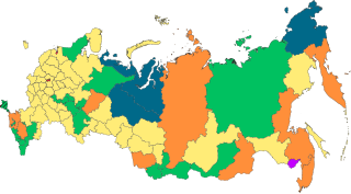
English: Copy of File:Map of federal subjects of Russia (2014).svg with disputed annexed territories indicated with diagonal stripes |
| 日期 | |
| 来源 |
自己的作品. 本檔案衍生自: Map of federal subjects of Russia (2014).svg |
| 作者 | Mzajac |
.svg)
许可协议
| 此地图不符合版权的资格,因此属于公有领域,因为其完全包含公共财产信息,不包含原作者身份。详情参见Commons:Threshold of originality § Maps。
|
文件历史
点击某个日期/时间查看对应时刻的文件。
| 日期/时间 | 缩略图 | 大小 | 用户 | 备注 | |
|---|---|---|---|---|---|
| 当前 | 2022年12月31日 (六) 01:22 | | 512 × 282(723 KB) | CiudadDeMexico | Reverted to version as of 23:26, 18 December 2022 (UTC) |
| 2022年12月31日 (六) 01:22 |  | 512 × 282(827 KB) | CiudadDeMexico | Reverted to version as of 23:17, 18 December 2022 (UTC) | |
| 2022年12月18日 (日) 23:26 |  | 512 × 282(723 KB) | Fender355 | Reverted to version as of 19:40, 4 October 2022 (UTC) | |
| 2022年12月18日 (日) 23:17 |  | 512 × 282(827 KB) | Fender355 | Reverted to version as of 20:44, 1 October 2022 (UTC) | |
| 2022年10月4日 (二) 19:40 |  | 512 × 282(723 KB) | Techso01 | Reverted to version as of 20:51, 25 March 2022 (UTC) according the title, try upload with other title | |
| 2022年10月1日 (六) 20:44 |  | 512 × 282(827 KB) | Ltbubbas | Added four disputed territories formally annexed by Russia, striped along with Crimea | |
| 2022年3月25日 (五) 20:51 |  | 512 × 282(723 KB) | Mzajac | Uploaded own work with UploadWizard |
文件用途
没有页面链接到本图像。
全域文件用途
以下其他wiki使用此文件:
- ar.wikipedia.org上的用途
- en.wikipedia.org上的用途
- th.wikipedia.org上的用途
- vi.wikipedia.org上的用途
,_disputed_Crimea.svg)