File:Map sagegrouse range2000.JPG
此为最大尺寸。
Map_sagegrouse_range2000.JPG (720 × 540像素,文件大小:62 KB,MIME类型:image/jpeg)
摘要
| 描述 |
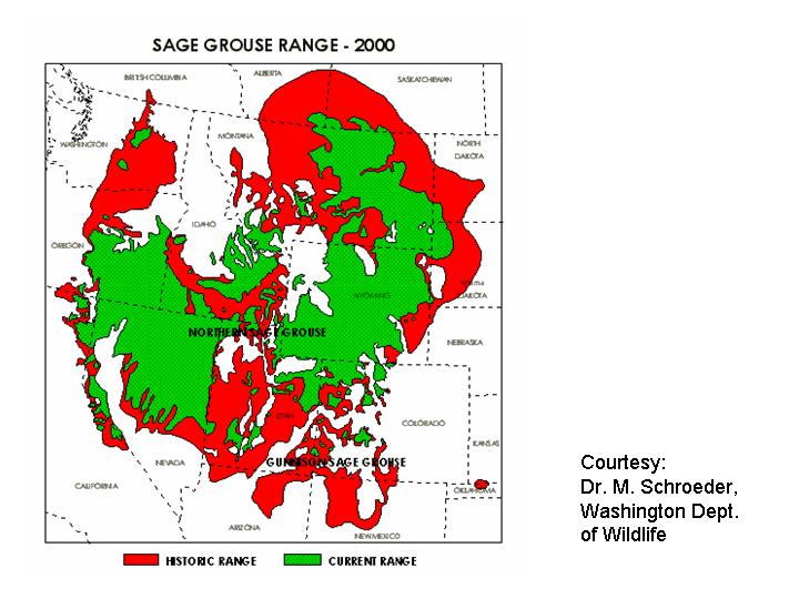
English: Range map of the Greater Sage Grouse (Centrocercus urophasianus) — historical (red) and present day (green) in western North America.
|
| 来源 | http://www.fws.gov/mountain-prairie/species/birds/sagegrouse/map_sagegrouse_range2000.JPG |
| 作者 | M. Schroeder |
许可协议
|
|
 |
文件历史
点击某个日期/时间查看对应时刻的文件。
| 日期/时间 | 缩略图 | 大小 | 用户 | 备注 | |
|---|---|---|---|---|---|
| 当前 | 2009年1月10日 (六) 13:26 | | 720 × 540(62 KB) | Whhalbert | {{Information |Description={{en|1=Range of Greater Sage Grouse (Centrocercus urophasianus), historical and present (2000). The U.S. Fish and Wildlife Service}} |Source=http://www.fws.gov/mountain-prairie/species/birds/sagegrouse/map_sagegrouse_range2000.J |
文件用途
以下页面使用本文件:
全域文件用途
以下其他wiki使用此文件:
- ceb.wikipedia.org上的用途
- de.wikipedia.org上的用途
- en.wiktionary.org上的用途
- ru.wikipedia.org上的用途
- sv.wikipedia.org上的用途
- vi.wikipedia.org上的用途