File:Mountain meadows map5.jpg
本预览的尺寸:644 × 599像素。 其他分辨率:258 × 240像素 | 516 × 480像素 | 909 × 846像素。
原始文件 (909 × 846像素,文件大小:176 KB,MIME类型:image/jpeg)

|
本文件已被Mountain meadows map5.png取代。建议您使用其他文件。请注意,删除被取代的图片需要达成一致。 使用其他文件的理由:“The new version is a copy of this image without whitespace and in the more appropriate en:PNG format.”
|

|
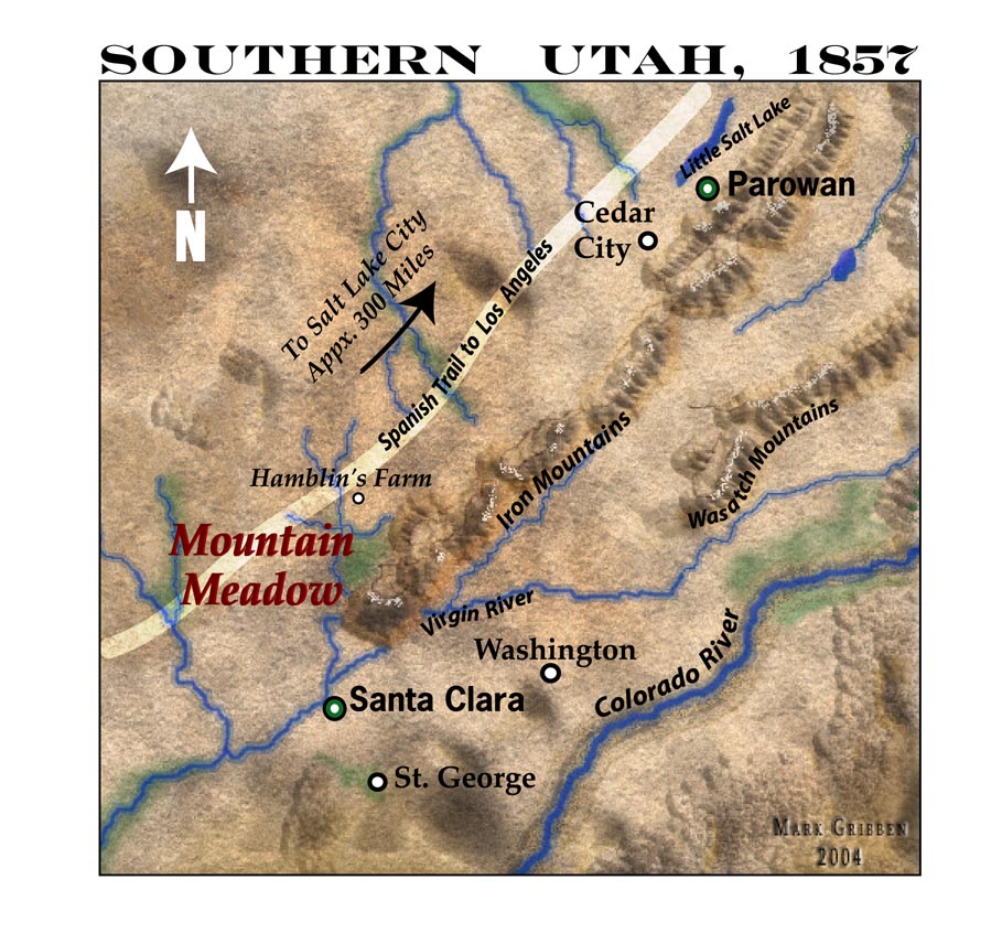
A 150-dpi JPEG Map of Southern Utah in 1857, highlighting the Mountain Meadows area including the Wasatch Mountains and Colorado River.
| 本作品已被作者marklemagne释出到公有领域。这适用于全世界。 在一些国家这可能不合法;如果是这样的话,那么: |
文件历史
点击某个日期/时间查看对应时刻的文件。
| 日期/时间 | 缩略图 | 大小 | 用户 | 备注 | |
|---|---|---|---|---|---|
| 当前 | 2005年5月13日 (五) 03:46 | | 909 × 846(176 KB) | Marklemagne~commonswiki | A 150-dpi JPEG Map of Southern Utah in 1857, highlighting the Mountain Meadows area including the Wasatch Mountains and Colorado River. {{PD-user|marklemagne}} |
文件用途
以下页面使用本文件:
全域文件用途
以下其他wiki使用此文件:
- ca.wikipedia.org上的用途
- de.wikipedia.org上的用途
- en.wikipedia.org上的用途
- eo.wikipedia.org上的用途
- fr.wikipedia.org上的用途
- hu.wikipedia.org上的用途