File:Mulholland Corridor.jpg
本预览的尺寸:800 × 542像素。 其他分辨率:320 × 217像素 | 640 × 434像素 | 1,024 × 694像素 | 1,261 × 855像素。
原始文件 (1,261 × 855像素,文件大小:800 KB,MIME类型:image/jpeg)
摘要
| 描述 |
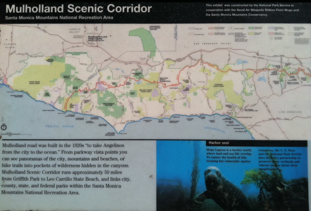
English: Map of Mulholland Highway — in the Santa Monica Mountains National Recreation Area.
|
| 日期 | |
| 来源 | Photograph of a U.S. National Park Service map. |
| 作者 | Seanydelight |
许可协议
| This image or media file contains material based on a work of a United States Department of the Interior employee, created as part of that person's official duties. As a work of the U.S. federal government, such work is in the public domain in the United States. See the Department of the Interior copyright policy for more information. |  |
文件历史
点击某个日期/时间查看对应时刻的文件。
| 日期/时间 | 缩略图 | 大小 | 用户 | 备注 | |
|---|---|---|---|---|---|
| 当前 | 2011年6月21日 (二) 05:52 | | 1,261 × 855(800 KB) | Seanydelight |
文件用途
以下页面使用本文件:
全域文件用途
以下其他wiki使用此文件:
- en.wikipedia.org上的用途