File:NYCS map 5.svg

此SVG文件的PNG预览的大小:490 × 599像素。 其他分辨率:196 × 240像素 | 393 × 480像素 | 628 × 768像素 | 838 × 1,024像素 | 1,676 × 2,048像素 | 648 × 792像素。
原始文件 (SVG文件,尺寸为648 × 792像素,文件大小:467 KB)
摘要
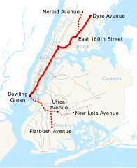
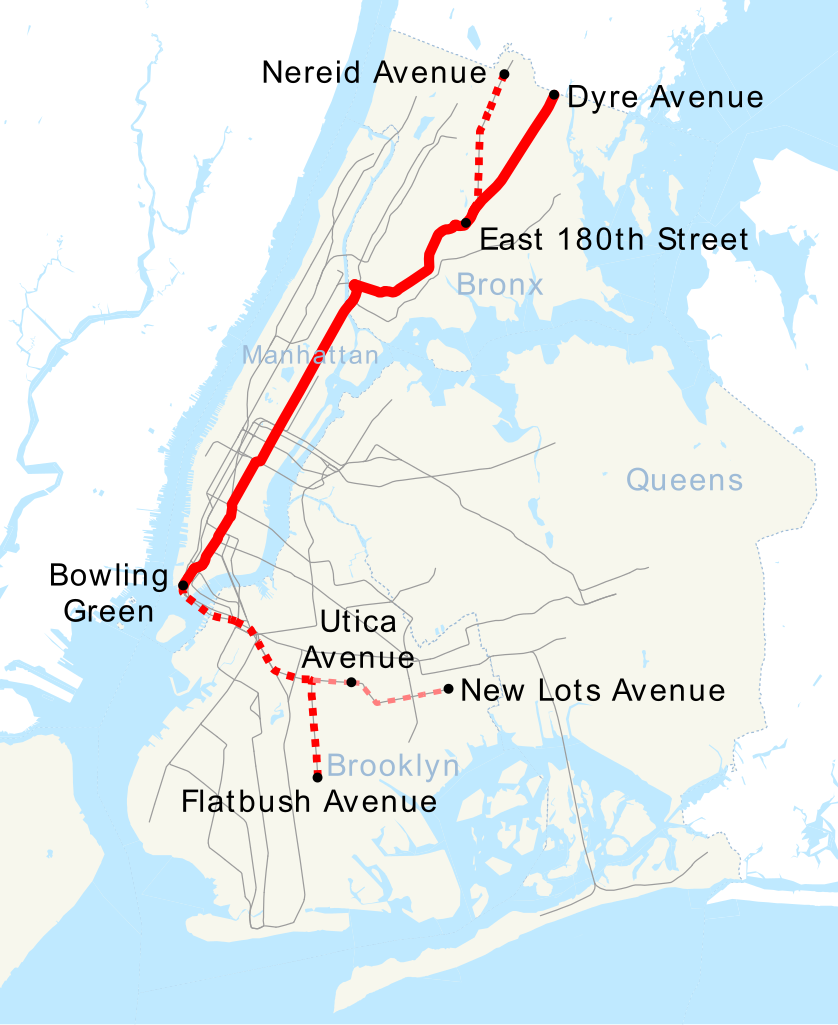
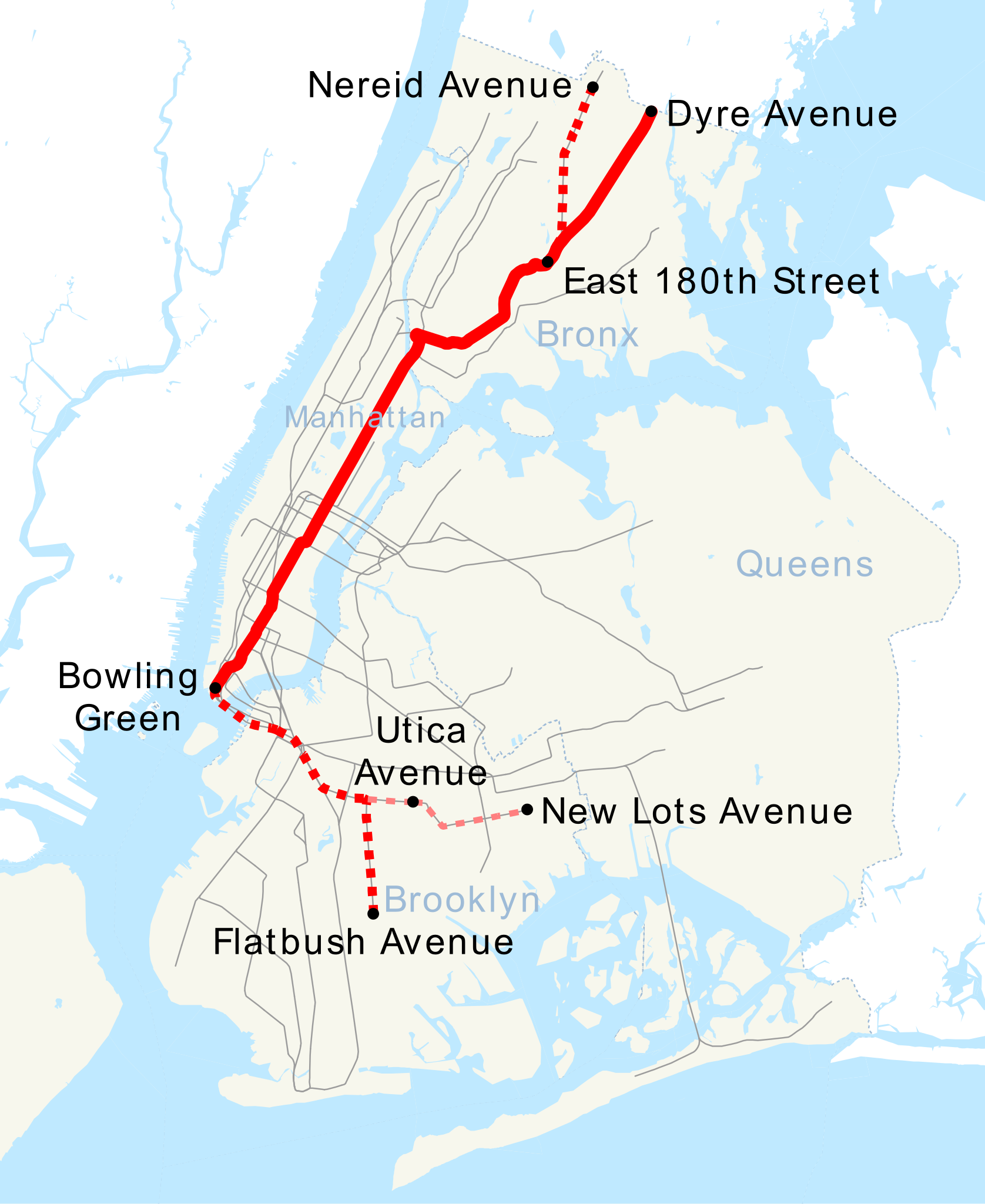
| 描述 | This is a map showing the New York City Subway's 5 service. It was created with TIGER/Line GIS data (water and boundaries) and my own data (subway lines and stations, traced on TIGER/Line road data). If you would like a copy of the subway data, email me. |
| 日期 | 2007年4月30日 (原始上传日期) |
| 来源 | 无法识别来源。根据版权声明推断为其自己的作品。 |
| 作者 | 无法识别作者。根据版权声明推断作者为NE2。 |
许可协议
| 我,本作品著作权人,释出本作品至公有领域。这适用于全世界。 在一些国家这可能不合法;如果是这样的话,那么: 我无条件地授予任何人以任何目的使用本作品的权利,除非这些条件是法律规定所必需的。 |
文件历史
点击某个日期/时间查看对应时刻的文件。
| 日期/时间 | 缩略图 | 大小 | 用户 | 备注 | |
|---|---|---|---|---|---|
| 当前 | 2018年7月6日 (五) 17:29 | | 648 × 792(467 KB) | Epicgenius | No more 241 St trips |
| 2018年6月24日 (日) 15:32 |  | 648 × 792(493 KB) | Epicgenius | format | |
| 2018年6月24日 (日) 15:24 |  | 648 × 792(467 KB) | Epicgenius | Clark St work is completed | |
| 2017年6月26日 (一) 16:44 |  | 648 × 792(493 KB) | PrecipiceofDuck | Map updated with Hurricane Sandy Fix & Fortify Clark St Tunnel work | |
| 2016年3月18日 (五) 21:53 |  | 648 × 792(467 KB) | PrecipiceofDuck | Map updated to add 7 line extension. | |
| 2011年11月4日 (五) 21:50 |  | 648 × 792(386 KB) | Train2104 | Text to path | |
| 2007年4月30日 (一) 23:59 |  | 648 × 792(400 KB) | NE2 | == Summary == This is a map showing the New York City Subway's 5 service. It was created with TIGER/Line GIS data (water and boundaries) and my own data (subway lines and stations, traced on TIGER/Line road data). If you would like a copy of the subway da |
文件用途
以下页面使用本文件:
全域文件用途
以下其他wiki使用此文件:
- ca.wikipedia.org上的用途
- de.wikipedia.org上的用途
- en.wikipedia.org上的用途
- es.wikipedia.org上的用途
- et.wikipedia.org上的用途
- fi.wikipedia.org上的用途
- fr.wikipedia.org上的用途
- he.wikipedia.org上的用途
- it.wikipedia.org上的用途
- ja.wikipedia.org上的用途
- ko.wikipedia.org上的用途
- lmo.wikipedia.org上的用途
- nl.wikipedia.org上的用途
- no.wikipedia.org上的用途
- pl.wikipedia.org上的用途
- pt.wikipedia.org上的用途
- ru.wikipedia.org上的用途
- www.wikidata.org上的用途