File:Netherlands, Winschoten, map, around 1865-1870.jpg

本预览的尺寸:698 × 600像素。 其他分辨率:279 × 240像素 | 558 × 480像素 | 894 × 768像素 | 1,191 × 1,024像素 | 1,396 × 1,200像素。
原始文件 (1,396 × 1,200像素,文件大小:648 KB,MIME类型:image/jpeg)
摘要
| 描述 |
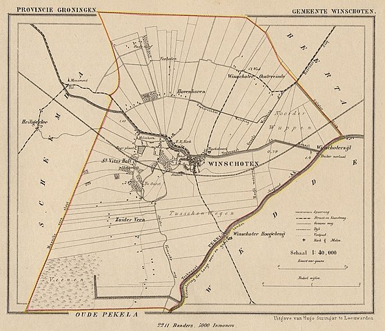
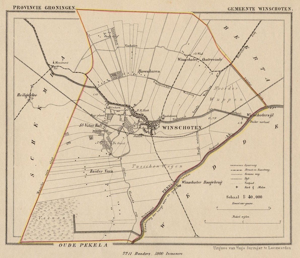
Nederlands: Kaart uit de periode 1865-1870 van de gemeente Winschoten (Prov. Groningen).
English: Map from around 1865-1870 of the municipality of Winschoten (Province of Groningen, Netherlands). |
| 日期 | Published around 1870 as part of a series of provincial atlases of the Netherlands. |
| 来源 | Gemeente-atlas van Nederland naar officieele bronnen bewerkt. |
| 作者 | J. Kuyper |
| 授权 (二次使用本文件) |
This image is in the public domain. The author J. Kuyper died in 1908. [In the Netherlands copyright expires 70 years after the death of the author or 70 years after first publication in the case of anonymous or pseudonymous works or works published by a legal entity]. [Het auteursrecht in Nederland vervalt 70 jaar na de dood van de auteur of 70 jaar na de eerste openbaarmaking van het werk, indien het gaat om een anoniem of om een onder pseudoniem verschenen werk of werk van een rechtspersoon]. |
许可协议
|
本作品在其来源国以及其他著作权期限是作者逝世后70年或以下的国家和地区属于公有领域。
| |
| 本文件已被确认为免除已知的著作权法限制(包括所有相关权利)。 | |
The old town hall of Winschoten is at:
| 相机位置 | | 在以下服务上查看本图像和附近其他图像: OpenStreetMap |
|---|
文件历史
点击某个日期/时间查看对应时刻的文件。
| 日期/时间 | 缩略图 | 大小 | 用户 | 备注 | |
|---|---|---|---|---|---|
| 当前 | 2011年11月25日 (五) 10:02 | | 1,396 × 1,200(648 KB) | Loranchet | {{Information |Description ={{nl|1=Kaart uit de periode 1865-1870 van de gemeente Winschoten (Prov. Groningen).}} {{en|1=Map from around 1865-1870 of the municipality of Winschoten (Province of Groningen, Netherlands).}} |Source =Gemeente-atlas |
文件用途
以下页面使用本文件:
全域文件用途
以下其他wiki使用此文件:
- en.wikipedia.org上的用途
- fy.wikipedia.org上的用途
- nl.wikipedia.org上的用途
- www.wikidata.org上的用途