File:Overview of West Lancaster.jpg

本预览的尺寸:800 × 596像素。 其他分辨率:320 × 239像素 | 640 × 477像素 | 1,024 × 763像素 | 1,280 × 954像素 | 2,576 × 1,920像素。
原始文件 (2,576 × 1,920像素,文件大小:2.02 MB,MIME类型:image/jpeg)
| 描述 |
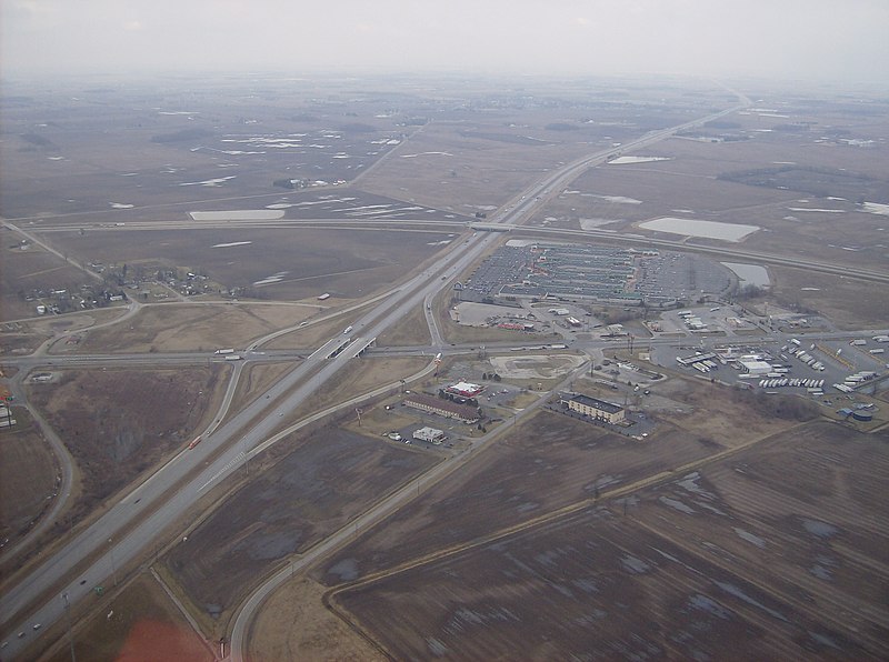
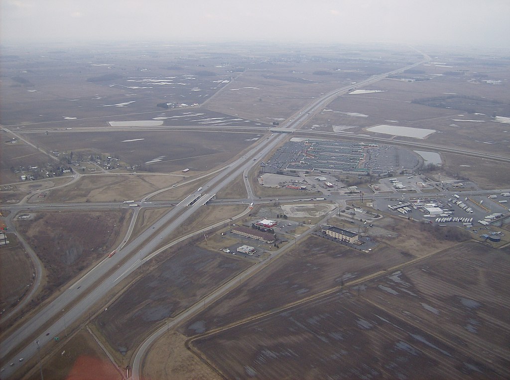
English: Aerial view of West Lancaster, a community in southern Jefferson Township, Fayette County, Ohio, United States. The village of Octa lies primarily just off the bottom edge of the picture, although its village limits extend along the road that appears from the picture's bottom edge. Picture taken from a Diamond Eclipse light airplane at an altitude of 2,500 feet MSL at an bearing of approximately 5º. The interchange is Interstate 71 over State Route 435, and the divided highway's overpass in the background is U.S. Route 35 passing over the interstate. |
||
| 日期 | 摄于2008年3月6日 | ||
| 来源 | 自己的作品 | ||
| 作者 | Nyttend | ||
| 授权 (二次使用本文件) |
|
| 註解 | 該圖片含有註解:在維基媒體共享資源上查看註解 |
文件历史
点击某个日期/时间查看对应时刻的文件。
| 日期/时间 | 缩略图 | 大小 | 用户 | 备注 | |
|---|---|---|---|---|---|
| 当前 | 2008年5月26日 (一) 03:42 | | 2,576 × 1,920(2.02 MB) | Nyttend | {{Information |Description=Aerial view of {{w|West Lancaster, Ohio|West Lancaster}}, a community in southern {{w|Jefferson Township, Fayette County, Ohio|Jefferson Township}}, {{w|Fayette County, Ohio|Fayette County}}, {{w|Ohio}}, {{w|United States}}. Pi |
文件用途
以下2个页面使用本文件:
全域文件用途
以下其他wiki使用此文件:
- ar.wikipedia.org上的用途
- arz.wikipedia.org上的用途
- ca.wikipedia.org上的用途
- en.wikipedia.org上的用途
- es.wikipedia.org上的用途
- eu.wikipedia.org上的用途
- fr.wikipedia.org上的用途
- ht.wikipedia.org上的用途
- it.wikipedia.org上的用途
- ja.wikipedia.org上的用途
- lld.wikipedia.org上的用途
- pl.wikipedia.org上的用途
- pt.wikipedia.org上的用途
- sh.wikipedia.org上的用途
- sr.wikipedia.org上的用途
- uk.wikipedia.org上的用途
- vi.wikipedia.org上的用途
- www.wikidata.org上的用途
- zh-min-nan.wikipedia.org上的用途