File:PIA20122-Ceres-DwarfPlanet-Dawn-3rdMapOrbit-HAMO-image60-20151003.jpg

原始文件 (1,024 × 1,024像素,文件大小:119 KB,MIME类型:image/jpeg)
摘要
| 描述 |
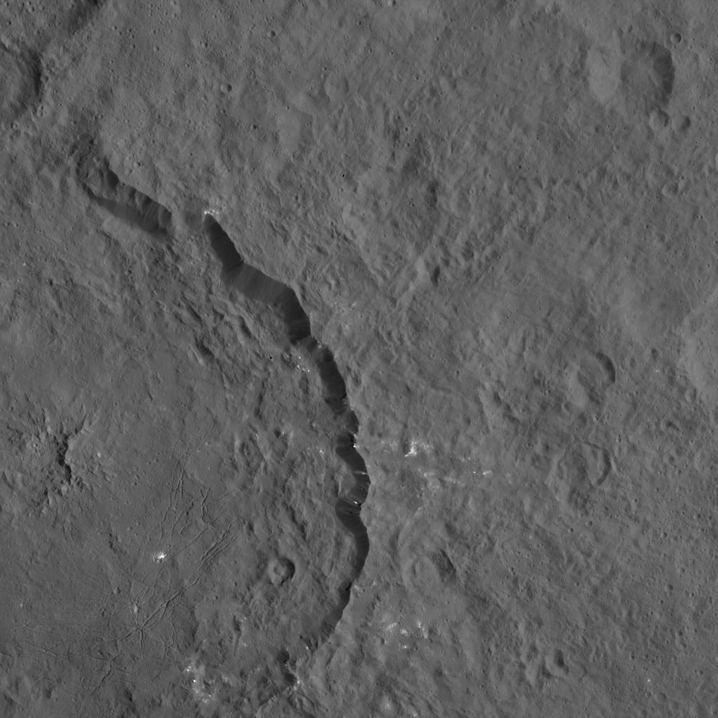
English: PIA20122: Dawn HAMO Image 60
http://photojournal.jpl.nasa.gov/catalog/PIA20122 Dantu crater on Ceres, seen here at left, reveals structures hinting at tectonic processes that formed the dwarf planet's surface. Linear structures are spread over the crater floor. Outside the crater's rim, the occurrence of linear structures continues the in form of scarps (linear, cliff-like slopes) and ridges. Dantu's diameter is 78 miles (125 kilometers). The image was taken by NASA's Dawn spacecraft on Oct. 3, 2015, from an altitude of 915 miles (1,470 kilometers). It has a resolution of 450 feet (140 meters) per pixel. The image is located at 31 degrees north latitude, 149 degrees east longitude. Dawn's mission is managed by JPL for NASA's Science Mission Directorate in Washington. Dawn is a project of the directorate's Discovery Program, managed by NASA's Marshall Space Flight Center in Huntsville, Alabama. UCLA is responsible for overall Dawn mission science. Orbital ATK, Inc., in Dulles, Virginia, designed and built the spacecraft. The German Aerospace Center, the Max Planck Institute for Solar System Research, the Italian Space Agency and the Italian National Astrophysical Institute are international partners on the mission team. For a complete list of acknowledgments, see http://dawn.jpl.nasa.gov/mission. For more information about the Dawn mission, visit http://dawn.jpl.nasa.gov. |
| 日期 | |
| 来源 | http://photojournal.jpl.nasa.gov/jpeg/PIA20122.jpg |
| 作者 | NASA/JPL-Caltech/UCLA/MPS/DLR/IDA |
许可协议
| 本文件完全由NASA创作,在美国属于公有领域。根据NASA的版权方针,NASA的材料除非另有声明否则不受版权保护。(参见Template:PD-USGov/zh、NASA版权方针页面或JPL图片使用方针。) | ||
 |
警告:
|
文件历史
点击某个日期/时间查看对应时刻的文件。
| 日期/时间 | 缩略图 | 大小 | 用户 | 备注 | |
|---|---|---|---|---|---|
| 当前 | 2015年11月16日 (一) 17:13 | | 1,024 × 1,024(119 KB) | Drbogdan | User created page with UploadWizard |
文件用途
以下页面使用本文件:
全域文件用途
以下其他wiki使用此文件:
- es.wikipedia.org上的用途