File:Rio Tambo.png
本预览的尺寸:518 × 600像素。 其他分辨率:207 × 240像素 | 414 × 480像素 | 948 × 1,098像素。
原始文件 (948 × 1,098像素,文件大小:2.28 MB,MIME类型:image/png)
摘要
| 描述 |
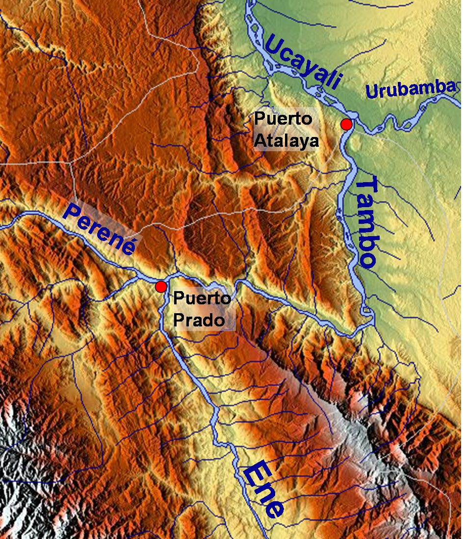
English: Map of the relief of the landscape around Tambo River, Peru |
| 日期 | |
| 来源 | http://www.maps-for-free.com/ |
| 作者 | Roar Johansen |
| 授权 (二次使用本文件) |
http://www.maps-for-free.com/html/about.html |
许可协议

|
已授权您依据自由软件基金会发行的无固定段落及封面封底文字(Invariant Sections, Front-Cover Texts, and Back-Cover Texts)的GNU自由文件许可协议1.2版或任意后续版本的条款,复制、传播和/或修改本文件。该协议的副本请见“GNU Free Documentation License”。 |
}}
文件历史
点击某个日期/时间查看对应时刻的文件。
| 日期/时间 | 缩略图 | 大小 | 用户 | 备注 | |
|---|---|---|---|---|---|
| 当前 | 2009年1月11日 (日) 12:26 | | 948 × 1,098(2.28 MB) | Roarjo | {{Information |Description= |Source= |Date= |Author= |Permission= |other_versions= }} |
| 2009年1月10日 (六) 11:57 |  | 948 × 1,098(2.28 MB) | Roarjo | == Description == {{Information |Description={{en|Map of the relief of the |Source=http://www.maps-for-free.com/ |Author=Roar Johansen |Date=2009 |Permission=http://www.maps-for-free.com/html/about.html |other_versions= }} == [[Commons:Co |
文件用途
以下页面使用本文件:
全域文件用途
以下其他wiki使用此文件:
- ceb.wikipedia.org上的用途
- cs.wikipedia.org上的用途
- de.wikipedia.org上的用途
- en.wikipedia.org上的用途
- es.wikipedia.org上的用途
- fr.wikipedia.org上的用途
- hr.wikipedia.org上的用途
- nl.wikipedia.org上的用途
- nn.wikipedia.org上的用途
- no.wikipedia.org上的用途
- qu.wikipedia.org上的用途
- sr.wikipedia.org上的用途
- vi.wikipedia.org上的用途
- www.wikidata.org上的用途