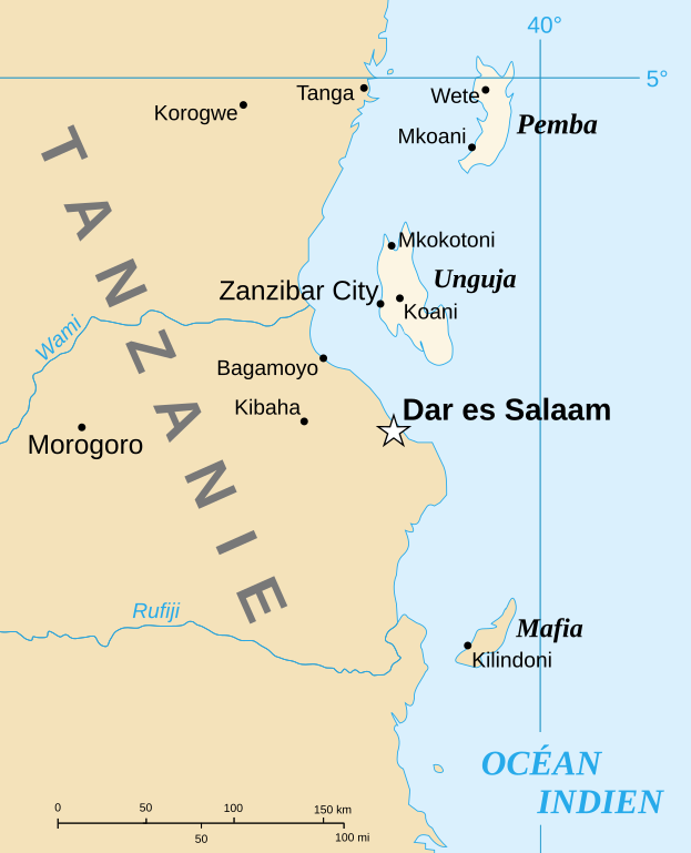
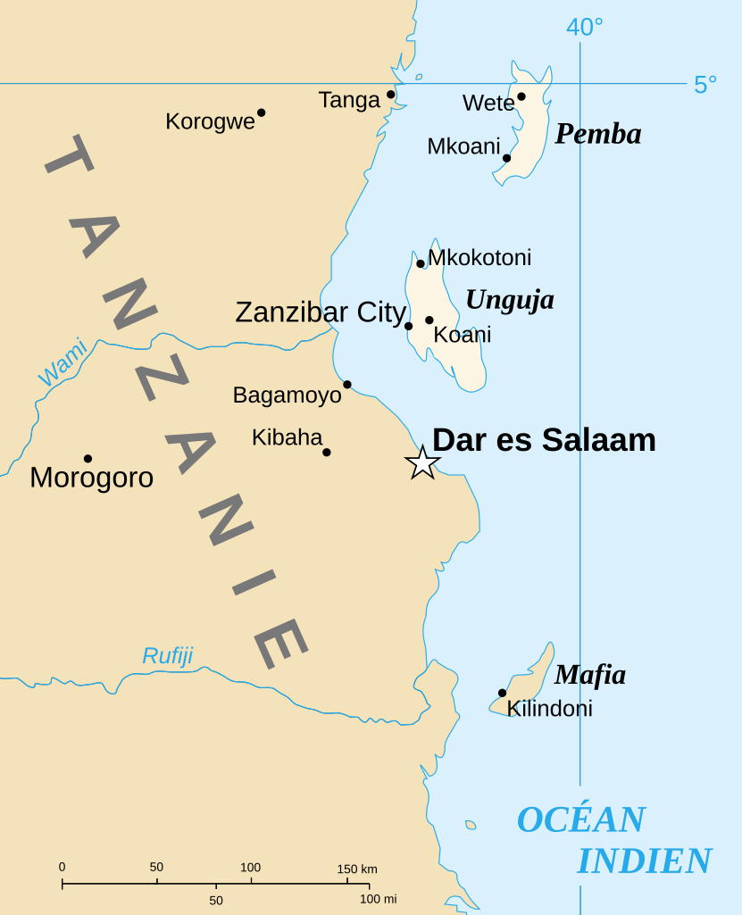
File:Spice Islands-Zanzibar highlighted-fr.svg

此SVG文件的PNG预览的大小:486 × 599像素。 其他分辨率:195 × 240像素 | 389 × 480像素 | 623 × 768像素 | 831 × 1,024像素 | 1,661 × 2,048像素 | 713 × 879像素。
原始文件 (SVG文件,尺寸为713 × 879像素,文件大小:24 KB)
摘要
| 描述 |
English: Part of the map of Tanzania in French, showing the Spice Islands. Français : Détail de la carte de Tanzanie en français montrant l'archipel de Zanzibar. |
| 日期 | of the translation : July 2007 |
| 来源 | Image:Spice Islands (Zanzibar highlighted).svg created by Mysid |
| 作者 | of the translation : Sting |
| 授权 (二次使用本文件) |
PD |
| 其他版本 |
Image:Spice_Islands_Tanzania-fr.svg in English : Image:Spice Islands (Tanzania).svg in English : Image:Spice Islands (Zanzibar highlighted).svg |
.svg)
.svg)

|
此SVG檔案包含可翻譯至您的語言的内嵌文字,可以使用任何可用SVG編輯器、文本編輯器或SVG翻譯工具來翻譯。詳情請見:關於翻譯SVG檔案。 |
许可协议
| 我,本作品著作权人,释出本作品至公有领域。这适用于全世界。 在一些国家这可能不合法;如果是这样的话,那么: 我无条件地授予任何人以任何目的使用本作品的权利,除非这些条件是法律规定所必需的。 |
| This work was previously under Public Domain, or a Free License. It has been digitally enhanced and/or modified. This derivative work has been (or is hereby) released into the public domain by its author, Sting at the French Wikipedia project. This applies worldwide. 在一些国家这可能不合法;如果是这样的话,那么:
|
文件历史
点击某个日期/时间查看对应时刻的文件。
| 日期/时间 | 缩略图 | 大小 | 用户 | 备注 | |
|---|---|---|---|---|---|
| 当前 | 2007年7月6日 (五) 13:31 | | 713 × 879(24 KB) | Sting | {{Information |Description={{en|Part of the map of Tanzania in French, showing the Spice Islands.}}{{fr|Détail de la carte de Tanzanie en français montrant l'archipel de Zanzibar.}} |Source=[[:Image:Spice |
文件用途
以下页面使用本文件:
全域文件用途
以下其他wiki使用此文件:
- el.wikipedia.org上的用途
- en.wikipedia.org上的用途
- es.wikipedia.org上的用途
- fr.wikipedia.org上的用途
- uk.wikipedia.org上的用途