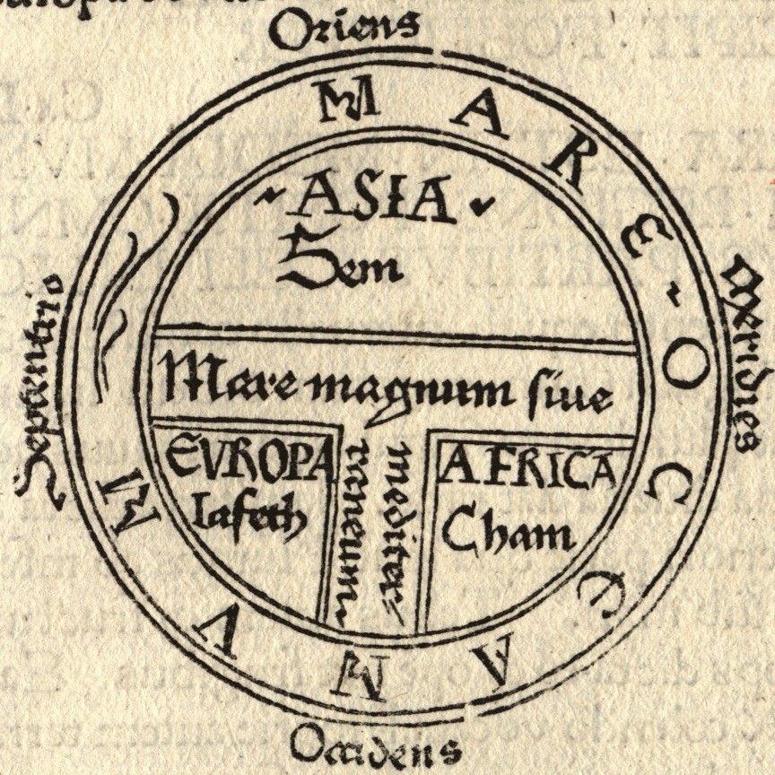
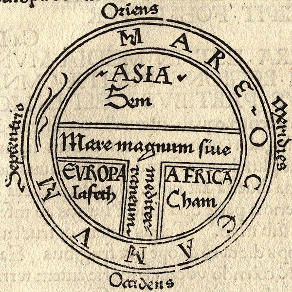
File:T and O map Guntherus Ziner 1472.jpg
本预览的尺寸:600 × 600像素。 其他分辨率:240 × 240像素 | 480 × 480像素 | 864 × 864像素。
原始文件 (864 × 864像素,文件大小:279 KB,MIME类型:image/jpeg)
摘要
| 艺术家 |
Isidore of Seville |
| 描述 |
|
| 来源/摄影师 |

许可协议
|
这是一个平面公有领域艺术品的忠实摄影副本。原艺术品本身因为下列原因属于公有领域:
维基媒体基金会的官方立场认为:“对平面公有领域艺术品的忠实再制作品也属于公有领域。”
因此,可以认为此摄影副本在美国也属于公有领域。在其他司法管辖区,再利用此内容可能存在限制;参见再利用PD-Art照片了解详细信息。 | ||||
文件历史
点击某个日期/时间查看对应时刻的文件。
| 日期/时间 | 缩略图 | 大小 | 用户 | 备注 | |
|---|---|---|---|---|---|
| 当前 | 2006年8月18日 (五) 22:43 | | 864 × 864(279 KB) | Ma xyz | Reverted to earlier revision |
| 2006年8月18日 (五) 22:42 |  | 224 × 238(18 KB) | Ma xyz | Reverted to earlier revision | |
| 2006年8月11日 (五) 06:34 |  | 864 × 864(279 KB) | Leinad-Z~commonswiki | Larger version, cropped from Image:T-O map 1472.jpg | |
| 2005年5月24日 (二) 10:25 |  | 224 × 238(18 KB) | Dbachmann | detail of Image:Etymologiae Guntherus Ziner 1472.jpg {{PD-art}} |
文件用途
以下页面使用本文件:
全域文件用途
以下其他wiki使用此文件:
- ar.wikipedia.org上的用途
- arz.wikipedia.org上的用途
- ast.wikipedia.org上的用途
- be.wikipedia.org上的用途
- bg.wikipedia.org上的用途
- bn.wikipedia.org上的用途
- bo.wikipedia.org上的用途
- br.wikipedia.org上的用途
- bs.wikipedia.org上的用途
- ca.wikipedia.org上的用途
- cs.wikipedia.org上的用途
- cv.wikipedia.org上的用途
- da.wikipedia.org上的用途
- de.wikipedia.org上的用途
- de.wikibooks.org上的用途
- el.wikipedia.org上的用途
- en.wikipedia.org上的用途
查看本文件的更多全域用途。