File:Tierra del Fuego location map.svg

原始文件 (SVG文件,尺寸为1,535 × 1,550像素,文件大小:824 KB)
摘要
| 描述 |
Deutsch: Positionskarte von Feuerland und Umgebung
Quadratische Plattkarte, N-S-Streckung 160 %. Geographische Begrenzung der Karte:
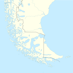
English: Location map of Tierra del Fuego and surroundings
Equirectangular projection, N/S stretching 160 %. Geographic limits of the map:
Español: Ubicación de Tierra del Fuego y alrededores
Proyección equirectangular, N/S 160% de estiramiento. Límites geográficos del mapa:
|
|
| 日期 | ||
| 来源 |
自己的作品, using
|
|
| 作者 | NordNordWest | |
| 授权 (二次使用本文件) |
本文件采用知识共享署名-相同方式共享 3.0 德国许可协议授权。
 本文件采用知识共享署名-相同方式共享 3.0 德国许可协议授权。
|
|
| 其他版本 |
此文件衍生的作品: |

.svg)

|
|
文件历史
点击某个日期/时间查看对应时刻的文件。
| 日期/时间 | 缩略图 | 大小 | 用户 | 备注 | |
|---|---|---|---|---|---|
| 当前 | 2024年3月5日 (二) 16:20 | | 1,535 × 1,550(824 KB) | Janitoalevic | More specific Beagle Channel |
| 2022年12月29日 (四) 01:23 |  | 1,535 × 1,550(588 KB) | Janitoalevic | Improved borders | |
| 2020年5月3日 (日) 19:41 |  | 1,535 × 1,550(566 KB) | Janitoalevic | Improved Isla de los Estados | |
| 2020年5月3日 (日) 18:47 |  | 1,535 × 1,550(558 KB) | Janitoalevic | Improved | |
| 2017年8月29日 (二) 23:23 |  | 1,535 × 1,550(441 KB) | Janitoalevic | Fixed size | |
| 2017年8月29日 (二) 11:23 |  | 1,535 × 1,550(510 KB) | NordNordWest | Reverted to version as of 20:59, 15 March 2016 (UTC); change of size is catastrophic to some templates | |
| 2017年8月28日 (一) 22:18 |  | 1,638 × 1,653(442 KB) | Janitoalevic | More precise borders and lakes | |
| 2016年3月15日 (二) 20:59 |  | 1,535 × 1,550(510 KB) | Janitoalevic | Fixed limits following Google Earth/maps limits | |
| 2016年3月2日 (三) 22:12 |  | 1,535 × 1,550(510 KB) | Janitoalevic | Updated | |
| 2015年9月11日 (五) 20:34 |  | 1,535 × 1,550(508 KB) | Janitoalevic | Added Southern Patagonian Ice Field (Campo de hielo Patagónico Sur) undefined limits part, since 1998 For more information read: https://en.wikipedia.org/wiki/Southern_Patagonian_Ice_Field#Borderline Now with full resolution. |
文件用途
以下8个页面使用本文件:
全域文件用途
以下其他wiki使用此文件:
- als.wikipedia.org上的用途
- ar.wikipedia.org上的用途
- az.wikipedia.org上的用途
- ba.wikipedia.org上的用途
- bn.wikipedia.org上的用途
- ceb.wikipedia.org上的用途
- cs.wikipedia.org上的用途
- da.wikipedia.org上的用途
- de.wikipedia.org上的用途
- el.wikipedia.org上的用途
- en.wikipedia.org上的用途
- Tierra del Fuego
- Ushuaia – Malvinas Argentinas International Airport
- Isla Grande de Tierra del Fuego
- Puerto Williams
- Río Grande, Tierra del Fuego
- Diego Ramírez Islands
- Riesco Island
- Hoste Island
- Viedma (volcano)
- Cerro Torre
- Fitz Roy
- Viedma Lake
- Gallegos River
- Mount Darwin (Andes)
- Puerto Toro
- Dawson Island
- Ildefonso Islands
- Hermite Islands
- Southern Patagonian Ice Field
- Navarino Island
- Cordillera Darwin
- Cordillera Sarmiento
- Londonderry Island
- Hornos Island
- Grey Lake
- Desolación Island
- Clarence Island, Chile
- Gordon Island
- Juan Guillermos Island
查看本文件的更多全域用途。