File:Tripura map.png
本预览的尺寸:413 × 599像素。 其他分辨率:165 × 240像素 | 331 × 480像素 | 899 × 1,304像素。
原始文件 (899 × 1,304像素,文件大小:164 KB,MIME类型:image/png)

|
此locator map图片可使用矢量图形重新创建为SVG文件。这具有很多好处;更多信息请参见共享资源:待清理媒体。如果存在此图片的SVG格式,请将其上传,然后将此模板替换为
{{vector version available|新图片名称}}。
建议您将SVG命名为“Tripura map.svg”,这样在使用Vector version available(或Vva)模板时就不需要填写新图片名称参数。 |
摘要
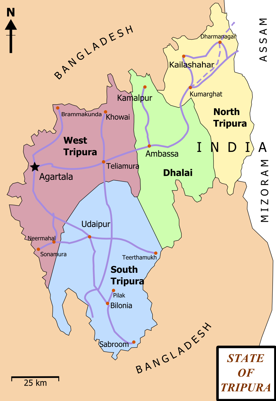
| 描述 | Map of State of Tripura. The map shows the former 4 districts of Tripura, with the state's roads and railway networks detailed. Railway was extended upto Agartala from Kumbarghat and opened by 2008.[1] |
| 日期 | |
| 来源 | 自己的作品 |
| 作者 | Wikigringo |
| 授权 (二次使用本文件) |
attribution to author. |
| 其他版本 | Tripura locator map blank.svg.png |
| 标题 |
Tripura locator map |
| 描写 |
Locator map of the state of Tripura, India with district boundaries. |
| 日期 | |
| 来源 |
自己的作品 |
| 創作作者 | |
| 授权 (二次使用本文件) |
我,本作品著作权人,特此采用以下许可协议发表本作品: 本文件采用知识共享署名-相同方式共享 3.0 未本地化版本许可协议授权。
|
| Geotemporal data | |
| 描繪日期 | 20世纪下半期和21世纪 |
| 地理参考 | 如果不适当,请设置 warp_status = skip 为隐藏。 |
| Archival data | |
| 备注 | Part of WikiProject India Maps |
许可协议
我,本作品著作权人,特此采用以下许可协议发表本作品:

|
已授权您依据自由软件基金会发行的无固定段落及封面封底文字(Invariant Sections, Front-Cover Texts, and Back-Cover Texts)的GNU自由文件许可协议1.2版或任意后续版本的条款,复制、传播和/或修改本文件。该协议的副本请见“GNU Free Documentation License”。 |
This file is licensed under the Creative Commons Attribution-Share Alike 4.0 International, 3.0 Unported, 2.5 Generic, 2.0 Generic and 1.0 Generic license.
- 您可以自由地:
- 共享 – 复制、发行并传播本作品
- 修改 – 改编作品
- 惟须遵守下列条件:
- 署名 – 您必须对作品进行署名,提供授权条款的链接,并说明是否对原始内容进行了更改。您可以用任何合理的方式来署名,但不得以任何方式表明许可人认可您或您的使用。
- 相同方式共享 – 如果您再混合、转换或者基于本作品进行创作,您必须以与原先许可协议相同或相兼容的许可协议分发您贡献的作品。
您可以选择您需要的许可协议。
文件历史
点击某个日期/时间查看对应时刻的文件。
| 日期/时间 | 缩略图 | 大小 | 用户 | 备注 | |
|---|---|---|---|---|---|
| 当前 | 2012年2月15日 (三) 17:06 | | 899 × 1,304(164 KB) | Ras67 | cropped and optimized |
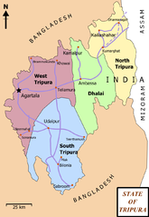
| 2008年2月27日 (三) 13:15 |  | 921 × 1,326(229 KB) | Wikigringo | {{Information |Description=Map of State of Tripura. Map shows the 4 districts of Tripura along with roadways and small railway network present in the state. |Source=self-made |Date=02/27/2008 |Author= Wikigringo |Permission=attribution |
文件用途
以下页面使用本文件:
全域文件用途
以下其他wiki使用此文件:
- as.wikipedia.org上的用途
- bn.wikipedia.org上的用途
- ধর্মনগর
- কমলপুর
- ত্রিপুরা বিধানসভা নির্বাচন, ২০১৩
- ত্রিপুরা বিধানসভা নির্বাচন, ২০০৮
- ত্রিপুরা বিধানসভা নির্বাচন, ২০০৩
- ত্রিপুরা বিধানসভা নির্বাচন, ১৯৭২
- ত্রিপুরা বিধানসভা নির্বাচন, ১৯৭৭
- ত্রিপুরা বিধানসভা নির্বাচন, ১৯৮৩
- ত্রিপুরা বিধানসভা নির্বাচন, ১৯৮৮
- ত্রিপুরা বিধানসভা নির্বাচন, ১৯৯৩
- ত্রিপুরা বিধানসভা নির্বাচন, ১৯৯৮
- ca.wikipedia.org上的用途
- en.wikipedia.org上的用途
- Portal:India/Selected picture candidates
- Belonia, India
- User:Gppande/Album
- Portal:India/Selected picture candidates/Tripura district map
- 2008 Tripura Legislative Assembly election
- Wikipedia:Graphics Lab/Map workshop/Archive/Apr 2013
- Santirbazar
- 2003 Tripura Legislative Assembly election
- 1998 Tripura Legislative Assembly election
- 1993 Tripura Legislative Assembly election
- 1988 Tripura Legislative Assembly election
- 1983 Tripura Legislative Assembly election
- 1977 Tripura Legislative Assembly election
- 1972 Tripura Legislative Assembly election
- eu.wikipedia.org上的用途
- fa.wikipedia.org上的用途
- gom.wikipedia.org上的用途
- hi.wikipedia.org上的用途
- hr.wikipedia.org上的用途
- incubator.wikimedia.org上的用途
- kk.wikipedia.org上的用途
- ml.wikipedia.org上的用途
- ne.wikipedia.org上的用途
- new.wikipedia.org上的用途
- no.wikipedia.org上的用途
查看本文件的更多全域用途。