File:TyphoonTingting2004.jpg

本预览的尺寸:490 × 599像素。 其他分辨率:196 × 240像素 | 393 × 480像素 | 628 × 768像素 | 838 × 1,024像素 | 1,676 × 2,048像素 | 7,200 × 8,800像素。
原始文件 (7,200 × 8,800像素,文件大小:5.6 MB,MIME类型:image/jpeg)
| 警告 | 部分浏览器在浏览此图片的完整大小时可能会遇到困难:该图片中有数量巨大的像素点,可能无法完全载入或者导致您的浏览器停止响应。 |
|---|
摘要
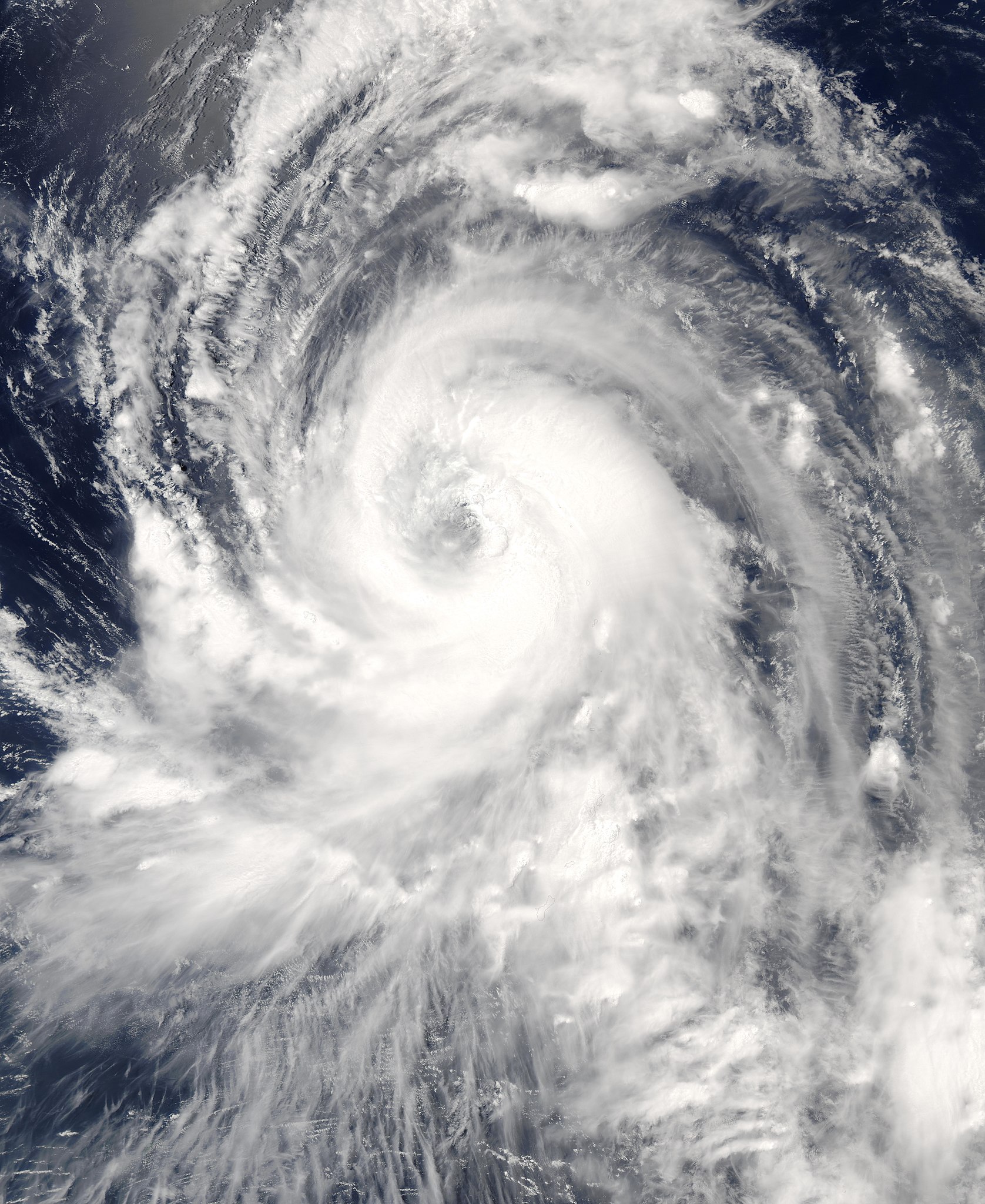
| 描述 | The MODIS instrument onboard NASA's Aqua (satellite) satellite captured this true-color image of Typhoon Tingting on June 29, 2004 at 3:45 UTC. At that time, Tingting was located approximately 345 miles south-southeast of Iwo Jima and was packing sustained winds of 92 mph with higher gusts to 115 mph. The storm was forecast to strengthen and continue on a west-northwest path. | |||||
| 日期 | June 30, 2004 | |||||
| 来源 | http://visibleearth.nasa.gov/view_rec.php?id=6874 | |||||
| 作者 | Jeff Schmaltz, MODIS Land Rapid Response Team at NASA GSFC. | |||||
| 授权 (二次使用本文件) |
|

文件历史
点击某个日期/时间查看对应时刻的文件。
| 日期/时间 | 缩略图 | 大小 | 用户 | 备注 | |
|---|---|---|---|---|---|
| 当前 | 2006年9月4日 (一) 23:01 | | 7,200 × 8,800(5.6 MB) | Good kitty | higher res... |
| 2006年8月22日 (二) 13:17 |  | 3,600 × 4,400(1.88 MB) | Irfanfaiz | {{Information |Description=The MODIS instrument onboard NASA's Aqua (satellite) satellite captured this true-color image of Typhoon Tingting on June 29, 2004 at 3:45 UTC. At that time, Tingting |
文件用途
以下2个页面使用本文件:
全域文件用途
以下其他wiki使用此文件:
- en.wikipedia.org上的用途
- ja.wikipedia.org上的用途
- th.wikipedia.org上的用途
- vi.wikipedia.org上的用途