File:US Geo survey hurricane jose 2017.jpg

本预览的尺寸:800 × 464像素。 其他分辨率:320 × 186像素 | 640 × 371像素 | 1,024 × 594像素 | 1,280 × 743像素 | 2,048 × 1,188像素。
原始文件 (2,048 × 1,188像素,文件大小:224 KB,MIME类型:image/jpeg)
摘要
| 描述 |
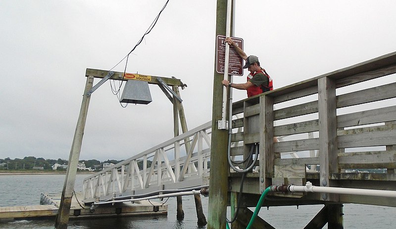
English: In response to Hurricane Jose, U.S. Geological Survey specialists across three states installed 17 storm-tide sensors – seven in Connecticut, seven in Massachusetts and three in Rhode Island – along shorelines likely to receive some large waves and storm surge from the storm.
These scientific instruments were put in place ahead of Jose to collect information about the hurricane’s effects on the coast. The retrieval of the sensors and the valuable data they hold will begin once Jose has passed. To learn where the storm-tide sensors were deployed for Jose, visit the USGS Hurricane Jose Flood Event Viewer. The U.S. Geological Survey use many forms of technology to track and document the effects of hurricanes along the Gulf and Atlantic coasts. |
| 日期 | |
| 来源 | https://www.facebook.com/USGeologicalSurvey/photos/a.169734339739224.34845.102635589782433/1544019712310673/?type=3&theater |
| 作者 | US Geological Survey |
许可协议
|
|
文件历史
点击某个日期/时间查看对应时刻的文件。
| 日期/时间 | 缩略图 | 大小 | 用户 | 备注 | |
|---|---|---|---|---|---|
| 当前 | 2017年9月19日 (二) 23:46 | | 2,048 × 1,188(224 KB) | Victorgrigas | User created page with UploadWizard |
文件用途
以下页面使用本文件:
全域文件用途
以下其他wiki使用此文件:
- en.wikipedia.org上的用途
- es.wikipedia.org上的用途