File:University-city-map.gif
此为最大尺寸。
University-city-map.gif (575 × 425像素,文件大小:82 KB,MIME类型:image/gif)

|
此文件是通过机器人脚本从en.wikipedia移动到维基共享资源的。来源中的所有信息均已保留,但仍需要人工的审阅。部分或所有的信息可能会出现在错误的区域;只有在经过审阅并修正需改正的错误后,此文件的相关信息才能视为可使用。当审阅结束后,请移除本模板,更详细的信息参见下方。 现在就开始检查! |
摘要
| 描述 | |
| 日期 |
|
| 来源 |
http://factfinder.census.gov/
|
| 作者 | Uploaded by Americasroof at en.wikipedia |
| 授权 (二次使用本文件) |
Public domain |
许可协议
This image or file is a work of a United States Census Bureau employee, taken or made as part of that person's official duties. As a work of the U.S. federal government, the image is in the public domain.
|
 |
原始上传日志
原始描述頁面位於這裡。下列使用者名稱均來自en.wikipedia。
Upload date | User | Bytes | Dimensions | Comment
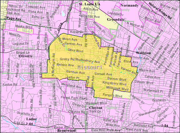
- 2008-01-08 03:39 (UTC) | Americasroof | 83890 (bytes) | 575×425 | {{Information |Description=U.S. Census Map of [[University City, Missouri]] |Source=http://factfinder.census.gov/servlet/SAFFFacts?_event=&geo_id=16000US2975220&_geoContext=01000US%7C04000US29%7C16000US2975220&_street=&_county=University+City&_cityTown=Un
文件历史
点击某个日期/时间查看对应时刻的文件。
| 日期/时间 | 缩略图 | 大小 | 用户 | 备注 | |
|---|---|---|---|---|---|
| 当前 | 2012年1月10日 (二) 12:38 | | 575 × 425(82 KB) | SreeBot | (Original text) : {{Information |Description=U.S. Census Map of University City, Missouri |Source=http://factfinder.census.gov/servlet/SAFFFacts?_event=&geo_id=16000US2975220&_geoContext=01000US%7C04000US29%7C16000US2975220&_street=&_county=University |
文件用途
以下页面使用本文件:
全域文件用途
以下其他wiki使用此文件:
- en.wikipedia.org上的用途
- fa.wikipedia.org上的用途
- sh.wikipedia.org上的用途
- ur.wikipedia.org上的用途