File:Volta districts.png
本预览的尺寸:776 × 600像素。 其他分辨率:311 × 240像素 | 621 × 480像素 | 994 × 768像素 | 1,056 × 816像素。
原始文件 (1,056 × 816像素,文件大小:43 KB,MIME类型:image/png)
摘要
| 描述 |
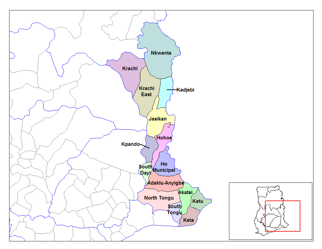
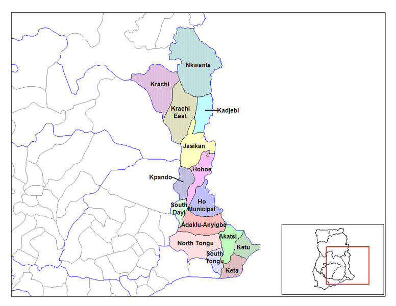
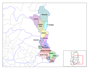
English: Map of the districts of the Volta region of Ghana. Created by Rarelibra for public domain use. Created using MapInfo Professional v7.5 and various mapping resources. |
| 日期 | 2006年6月28日 (原始上传日期) |
| 来源 | 自己的作品 |
| 作者 | User:Rarelibra |
许可协议
| 我,本作品著作权人,释出本作品至公有领域。这适用于全世界。 在一些国家这可能不合法;如果是这样的话,那么: 我无条件地授予任何人以任何目的使用本作品的权利,除非这些条件是法律规定所必需的。 |
原始上传日志
- (del) (cur) 08:03, 5 March 2006 . . Rarelibra (Talk | contribs) . . 1056x816 (44,138 bytes) (Map of the districts of the Volta region of Ghana. Created by Rarelibra for public domain use. Created using MapInfo Professional v7.5 and various mapping resources.)
文件历史
点击某个日期/时间查看对应时刻的文件。
| 日期/时间 | 缩略图 | 大小 | 用户 | 备注 | |
|---|---|---|---|---|---|
| 当前 | 2006年6月28日 (三) 14:01 | | 1,056 × 816(43 KB) | Ahanta | from en:districts of ghana Map of the districts of the Volta region of Ghana. Created by Rarelibra for public domain use. Created using MapInfo Professional v7.5 and various mapping resources. [edit] I, the creator of this work, hereby release it into th |
文件用途
没有页面链接到本图像。
全域文件用途
以下其他wiki使用此文件:
- ca.wikipedia.org上的用途
- ceb.wikipedia.org上的用途
- dag.wikipedia.org上的用途
- da.wikipedia.org上的用途
- de.wikipedia.org上的用途
- ee.wikipedia.org上的用途
- en.wikipedia.org上的用途
- es.wikipedia.org上的用途
- fa.wikipedia.org上的用途
- fr.wikipedia.org上的用途
- District (Ghana)
- Région de la Volta
- Adaklu-Anyigbe
- Akatsi
- Dayi sud
- Tongu nord
- Tongu sud
- Nkwanta sud
- Kpando
- Kadjebi
- Jasikan
- District municipal de Keta
- Ketu sud
- Ketu nord
- Nkwanta nord
- Biakoye
- District municipal d'Ho
- District municipal d'Hohoe
- Krachi est
- Krachi ouest
- Modèle:Infobox District du Ghana
- Modèle:Infobox District du Ghana/Documentation
- gpe.wikipedia.org上的用途
- ha.wikipedia.org上的用途
查看本文件的更多全域用途。