File:Wfm mono lake landsat.jpg

本预览的尺寸:800 × 593像素。 其他分辨率:320 × 237像素 | 640 × 474像素 | 1,024 × 758像素 | 1,280 × 948像素。
原始文件 (1,280 × 948像素,文件大小:217 KB,MIME类型:image/jpeg)
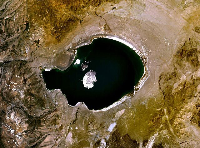
| 描述 | Mono Lake in California, USA. a NASA Landsat 7 image, final image made using NASA World Wind. | |||
| 日期 | 2006年10月21日 (原始上传日期) | |||
| 来源 | NASA WorldWind | |||
| 作者 | Finlay McWalter (留言 · 贡献) | |||
| 授权 (二次使用本文件) |
|

文件历史
点击某个日期/时间查看对应时刻的文件。
| 日期/时间 | 缩略图 | 大小 | 用户 | 备注 | |
|---|---|---|---|---|---|
| 当前 | 2006年10月21日 (六) 18:20 | | 1,280 × 948(217 KB) | Finlay McWalter | Mono Lake in California, USA NASA Landsat 7 image. Final image made using NASA World Wind. {{PD-WorldWind}} category:Lakes in California |
文件用途
以下页面使用本文件:
全域文件用途
以下其他wiki使用此文件:
- ar.wikipedia.org上的用途
- bg.wikipedia.org上的用途
- ceb.wikipedia.org上的用途
- cs.wikipedia.org上的用途
- da.wikipedia.org上的用途
- en.wikipedia.org上的用途
- es.wikipedia.org上的用途
- et.wikipedia.org上的用途
- fr.wikipedia.org上的用途
- fr.wikivoyage.org上的用途
- hu.wikipedia.org上的用途
- it.wikipedia.org上的用途
- ko.wikipedia.org上的用途
- li.wikipedia.org上的用途
- mg.wikipedia.org上的用途
- nl.wikipedia.org上的用途
- nn.wikipedia.org上的用途
- no.wikipedia.org上的用途
- pt.wikipedia.org上的用途
- ru.wikipedia.org上的用途
- sh.wikipedia.org上的用途
- sr.wikipedia.org上的用途
- te.wikipedia.org上的用途
- vi.wikipedia.org上的用途
- zh-yue.wikipedia.org上的用途