File:Wfm victoria island.jpg

本预览的尺寸:800 × 593像素。 其他分辨率:320 × 237像素 | 640 × 474像素 | 1,024 × 758像素 | 1,280 × 948像素。
原始文件 (1,280 × 948像素,文件大小:198 KB,MIME类型:image/jpeg)
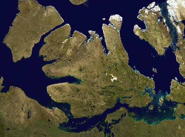
Victoria Island in the Canadian arctic.
NASA blue pearl data, collecter using NASA World Wind.
| 本圖像屬於公有領域,因其為NASA的World Wind衛星地圖瀏覽器的一張截圖,且使用了公有領域圖層,如Blue Marble、MODIS、Landsat、SRTM、USGS、GLOBE等。
|
 |
文件历史
点击某个日期/时间查看对应时刻的文件。
| 日期/时间 | 缩略图 | 大小 | 用户 | 备注 | |
|---|---|---|---|---|---|
| 当前 | 2006年4月9日 (日) 15:28 | | 1,280 × 948(198 KB) | Finlay McWalter | Victoria Island in the Canadian arctic. NASA blue pearl data, collecter using NASA World Wind. {{PD-USGov-NASA}} Category:Nunavut Category:Satellite images of islands Category:Satellite pictures of Canada |
文件用途
以下2个页面使用本文件:
全域文件用途
以下其他wiki使用此文件:
- af.wikipedia.org上的用途
- ar.wikipedia.org上的用途
- arz.wikipedia.org上的用途
- ast.wikipedia.org上的用途
- az.wikipedia.org上的用途
- bat-smg.wikipedia.org上的用途
- ba.wikipedia.org上的用途
- be-tarask.wikipedia.org上的用途
- be.wikipedia.org上的用途
- bg.wikipedia.org上的用途
- ca.wikipedia.org上的用途
- ceb.wikipedia.org上的用途
- cs.wikipedia.org上的用途
- cy.wikipedia.org上的用途
- de.wikipedia.org上的用途
- el.wikipedia.org上的用途
- en.wikipedia.org上的用途
- en.wikiversity.org上的用途
- eo.wikipedia.org上的用途
- es.wikipedia.org上的用途
- et.wikipedia.org上的用途
- eu.wikipedia.org上的用途
- fa.wikipedia.org上的用途
- fi.wikipedia.org上的用途
- frr.wikipedia.org上的用途
- fr.wikipedia.org上的用途
- fr.wikivoyage.org上的用途
查看本文件的更多全域用途。