File:Yamama english.jpg

本预览的尺寸:800 × 457像素。 其他分辨率:320 × 183像素 | 640 × 366像素 | 1,024 × 585像素 | 1,661 × 949像素。
原始文件 (1,661 × 949像素,文件大小:819 KB,MIME类型:image/jpeg)
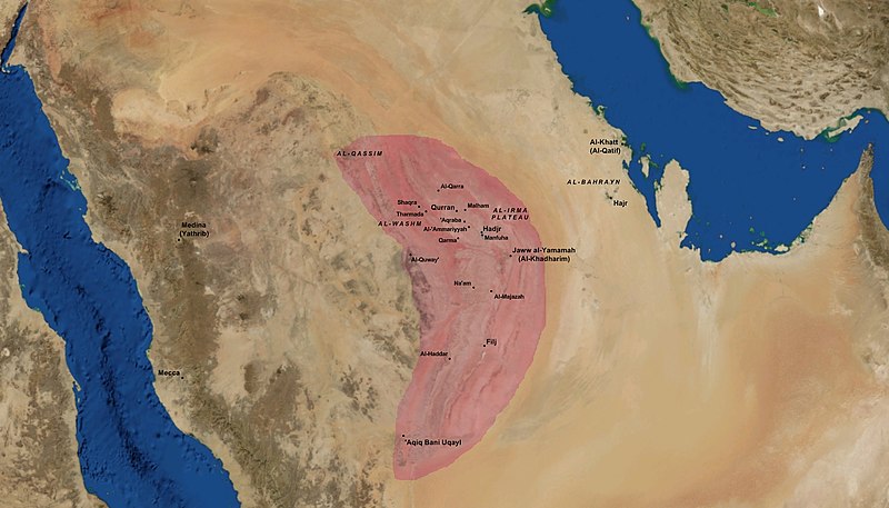
The historical province of Al-Yamamah at its greatest extent, as described by Yaqut and Al-Hamadani.
| 本圖像屬於公有領域,因其為NASA的World Wind衛星地圖瀏覽器的一張截圖,且使用了公有領域圖層,如Blue Marble、MODIS、Landsat、SRTM、USGS、GLOBE等。
|
 |
文件历史
点击某个日期/时间查看对应时刻的文件。
| 日期/时间 | 缩略图 | 大小 | 用户 | 备注 | |
|---|---|---|---|---|---|
| 当前 | 2007年6月15日 (五) 21:26 | | 1,661 × 949(819 KB) | Slackerlawstudent~commonswiki | The historical province of Al-Yamamah at its greatest extent, as described by Yaqut and Al-Hamadani. {{PD-WorldWind}} Category:Maps of Saudi Arabia |
文件用途
以下页面使用本文件:
全域文件用途
以下其他wiki使用此文件:
- bn.wikipedia.org上的用途
- ca.wikipedia.org上的用途
- de.wikipedia.org上的用途
- en.wikipedia.org上的用途
- es.wikipedia.org上的用途
- fa.wikipedia.org上的用途
- fr.wikipedia.org上的用途
- ha.wikipedia.org上的用途
- hi.wikipedia.org上的用途
- id.wikipedia.org上的用途
- it.wikipedia.org上的用途
- ja.wikipedia.org上的用途
- ml.wikipedia.org上的用途
- pt.wikipedia.org上的用途
- ru.wikipedia.org上的用途
- sr.wikipedia.org上的用途
- tr.wikipedia.org上的用途
- uk.wikipedia.org上的用途
- www.wikidata.org上的用途